


Montpellier Méditerranée Airport – Spotting Guide
March 1, 2021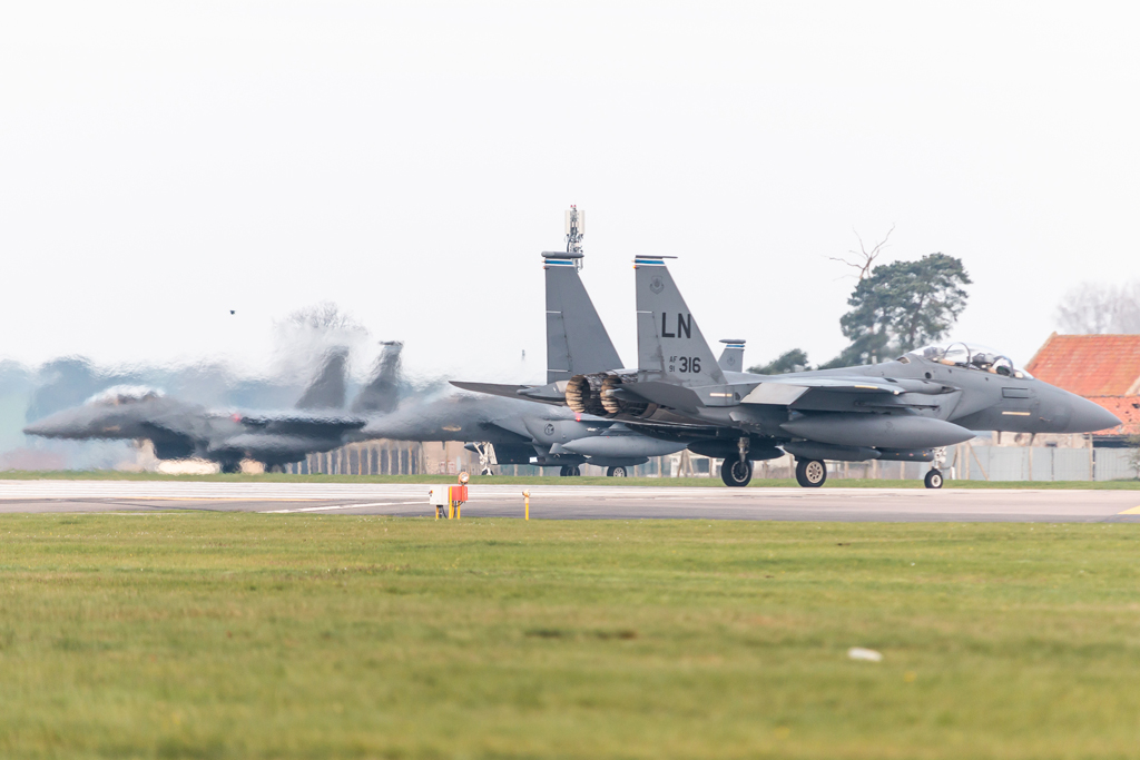
RAF Lakenheath Air Base – Spotting Guide
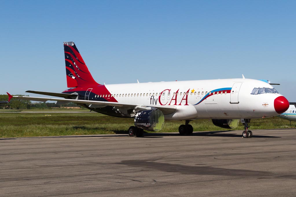
March 7, 2021Montpellier Méditerranée Airport – Spotting Guide
March 1, 2021RAF Lakenheath Air Base – Spotting Guide
March 7, 2021Kona Intl. Airport – Spotting Guide
- last modified on November 30, 2023
Kona International Airport (KOA/PHKO) serves roughly 4 million passengers a year now (as of 2019) and is sometimes also referred to as “Keahole-Kona Intl. Airport” as it is located at the westernmost peak (called Keahole) of Big island. This point was created by a lavaflow in 1801 which this airport is also built on and this is what makes spotting here so tricky and also special – due to the background and the spotting locations.
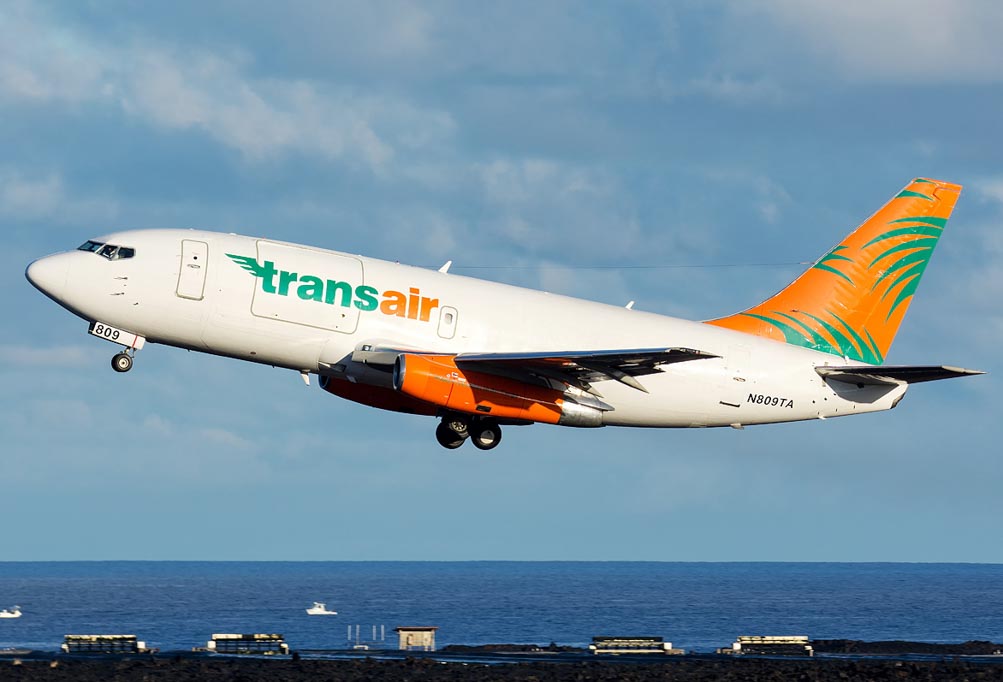
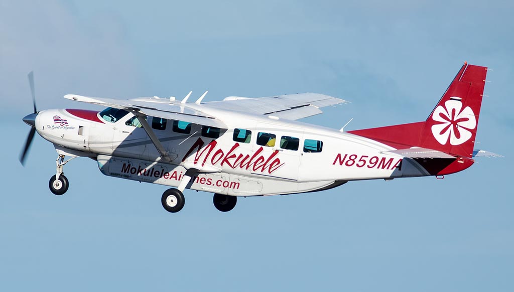
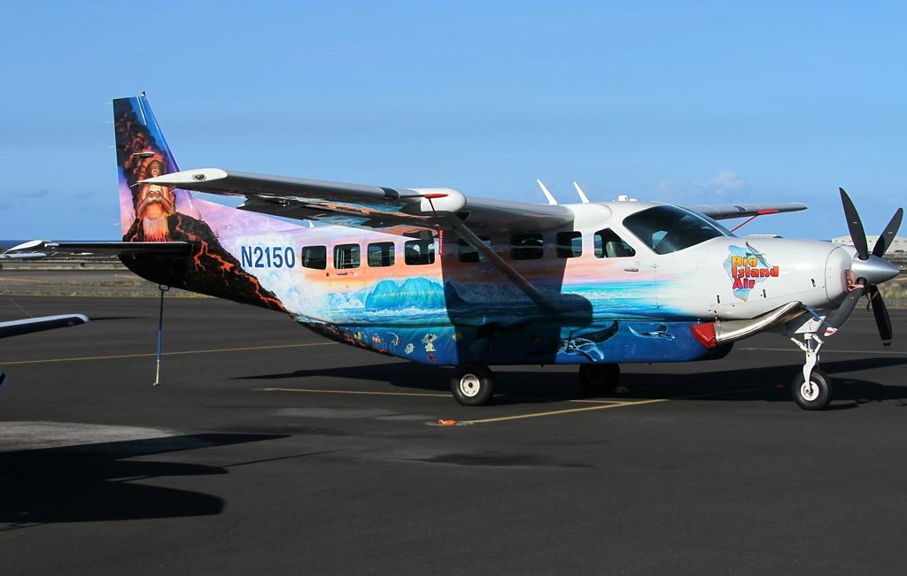
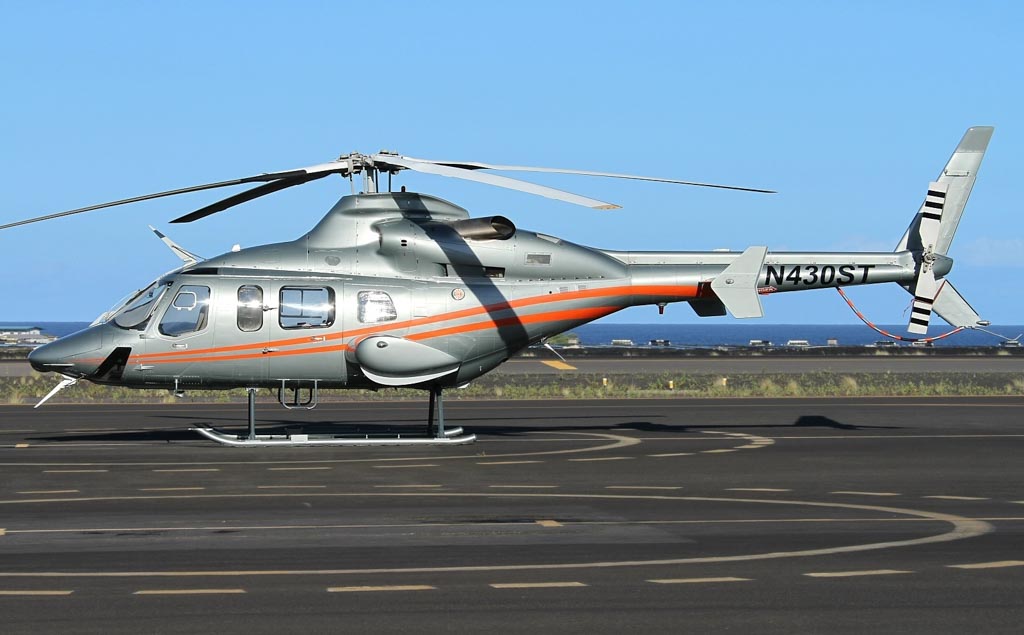
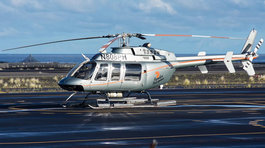
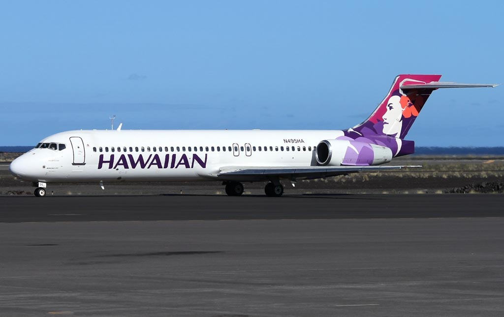
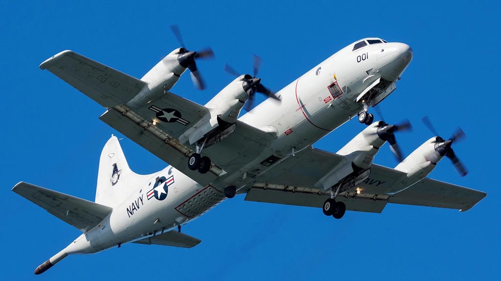
The airport was opened in 1970s and is the major gateway for Hawaii’s biggest island with its vulcans and stunning landscape. That is why KOA serves quite a few destinations on the US mainland directly, but also many routes to the other Hawaiian islands. You will see American, Alaska, Air Canada, Delta, Southwest, United and co here, but also Hawaiian, Mokulele, Makani Kai Air and O’hana aircraft on the local passenger routes. Japan Airlines (Tokyo), Air Canada and Westjet are the only foreign carriers. Furthermore some business jets, plenty of helicopter and other GA/sport aircraft. There are also a few military aicraft from time to time plus some freighters like UPS and Amazon and of course local freighters such as Aloha or Transair B737s in the mornings.
Written by Severin Hackenberger, Alan Lebeda and Kyle McKinlay. Last Update: July 2022 (Spot 1)
| Rating | |
| Movements | |
| Airline Variety | |
| Photo Locations | |
| Weather | |
| Airport Information | |
| Runways | |
| 17/35 | 3353m – 11000ft |
| Terminals | |
| Terminal 1 | Parking position 1-5 |
| Terminal 2 | Parking position 6-10 |
| Spotting Information | |
| Ladder | Not recommended, but actually you can spot from rocks or at least your car’s top everywhere so there is no real need for a ladder. |
| Car/Public Transport | Car definitely needed, otherwise you will not be able to get around here plus a car always works as ladder replacement. |
| Drinks/Food | Only inside the airport, otherwise the area directly around the airport has a minimal coverage of accomodation. |
| Hotels | There are some hotels/guesthouses up the hill to the east in Kalaoa. |
| Season | Summer has longer days and thus may allow catching the freighters in the morning, but it is also worse due to more heat haze. |
| Security | Spotting here is not very easy. The GAT south of the passenger terminal is fenced and secured with checkpoints and apart from this you may be sent away when being too close to the fence for a longer while. Keep a low profile! |
| Runway Usage | |
| 17/35 | 17 usage is more common than 35 movements. |
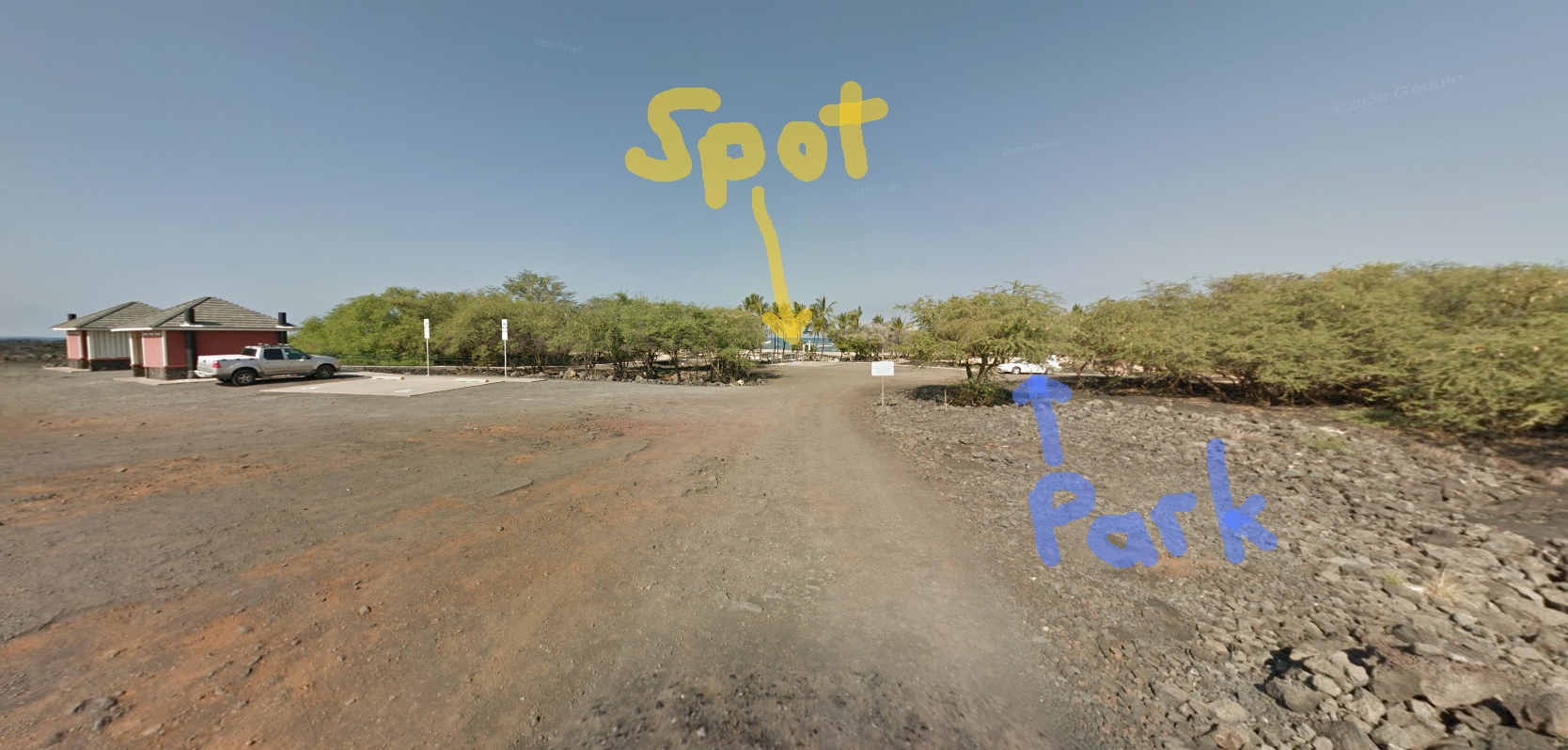
| Spot #1 – Rocks – 35 Arrivals, 35 Departures | |
|---|---|
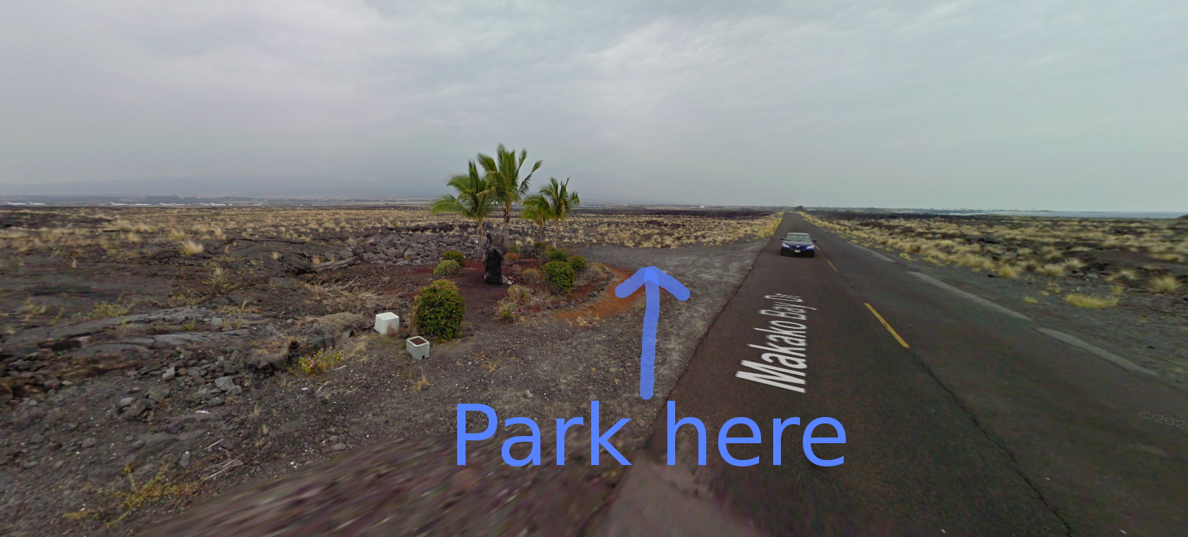
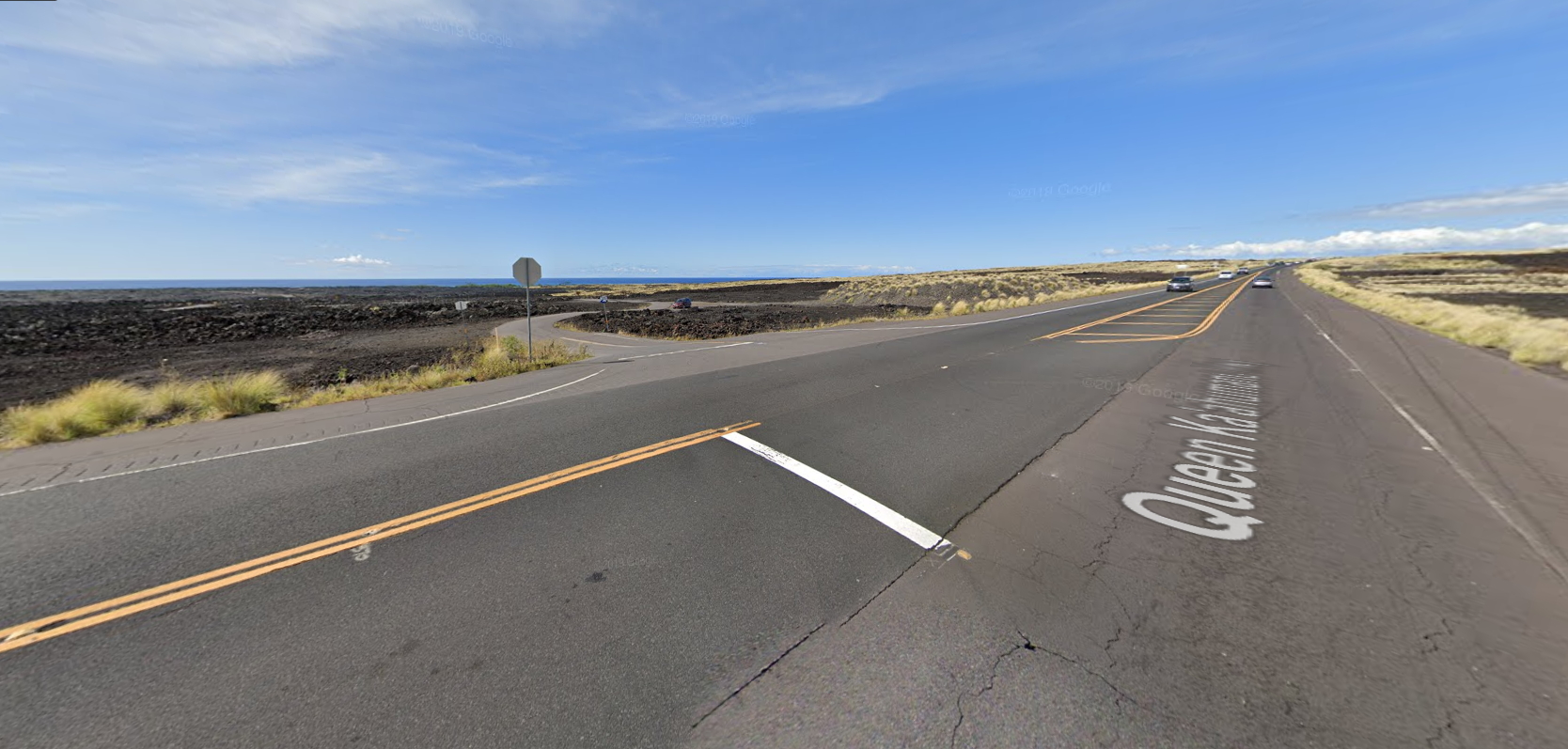
| WHERE | This spot is actually not an exact position, it is rather the area on the rocky underground just west of the runway’s southern end. In order to get here, turn off Queen Ka’ahumanu Highway to the west onto Makako Bay Drive. Head towards the Natural Energy Labatory at the coastal front, but park your car somewhere by the roadside between the runway’s arrival path and this labatory – we marked a possible bulge you can stop in on the map. Then head for the rocks north of the street, walk some meters towards the touchdown point and search your favourite position somewhere on the rocks here. |
| WHAT | From here you can see aircraft arriving on runway 35. but also 35 Departures. The aircraft taking off in front of the mountains and then making a sharp bank off to the continental United States. |
| TIME | From later noon till sunset. |
| MISC. | Nothing needed, but also nothing around. Wear proper shoes as the rocks are hard to climb and walk on. Bring everything you need with you and take care to park your car properly somewhere you are allowed to park it. |
| FOCAL LENGTH | 70-300mm B747 = 100mmDeparture: 717 or smaller: 170mm for takeoff, 340mm+ for banking 737 or 321N: 120mm for takeoff, 280mm+ for bank A330/787-10: 70mm for takeoff, 200mm for bank. |

Just park as marked below and then walk some meters towards touchdown point (left front here):
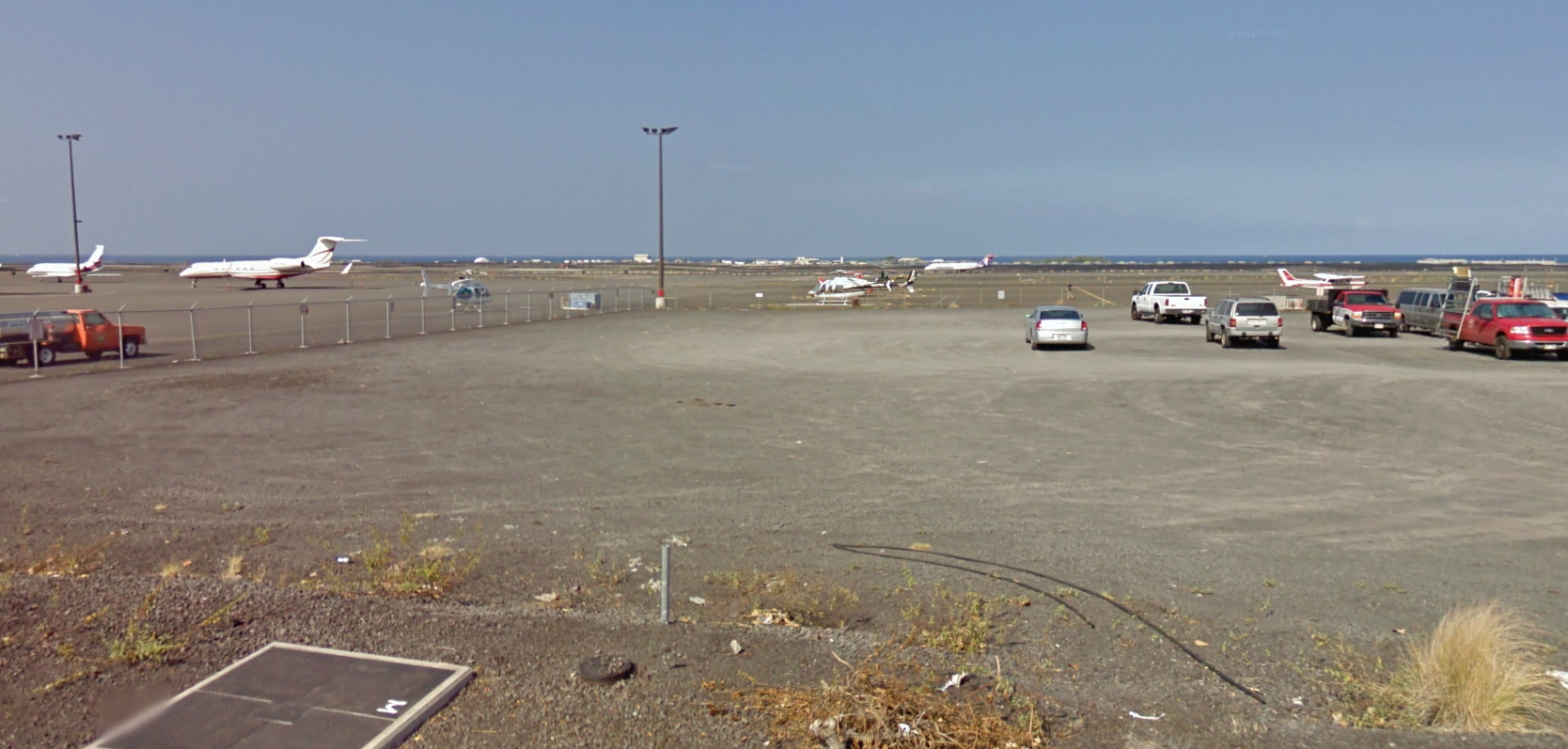
| Spot #2 – Gravel parking – 17/35 movements + Small GA/Helicopter Ramp | |
|---|---|
| WHERE | This spot is south of the airport’s passenger terminal on a gravel parking lot. Turn off Queen Ka’ahumanu Highway again and head on Keahole Airport Rd towards the airport terminal, but do not turn right/to the north at the end. Continue straight to the west and turn off to the left/south at the end. Then drive south on Uu street as marked and turn off onto a big car park on your right after a while. |
| WHAT | This spot offers nice views onto the northern GA ramp often used by small sports aircraft and helicopters. In addition, you can also nicely see movements on runway 17/35 plus nearby taxiways. For latter stay on the elevated road to clear the fence. For ramp shots go down to the fence. |
| TIME | From sunrise till early noon. |
| MISC. | We don’t know if you were allowed in, but we were there at 5am and didn’t stay for too long, so maybe we were lucky with security. |
| FOCAL LENGTH | 24-300mm |


| Spot #3 – Terminal – Passengerterminal Apron | |
|---|---|
| WHERE | This spot is located inside the terminal and can only be reached WITH A VALID BOARDING PASS. It’s located AIRSIDE, so AFTER SECURITY CHECK. So once you are in there, just search your favourite position at the terminal’s western front between the bushes/gates in one of the concourses (northern or southern). |
| WHAT | Here you have a nice view onto the passenger terminal’s apron and in the background you may also see nearby taxiway/runway movements at some points. |
| TIME | Depends on the angle and your exact position, but this spot works well from sunrise till early noon. |
| MISC. | Heat haze can be an issue here as well as foreground clutter and other objects, which can disturb your view heavily. But all you need as food and shadow are around you. Keep in mind, that you need a VALID BOARDING PASS to reach this spot, which is located AFTER SECURITY CHECK, so it’s AIRSIDE. |
| FOCAL LENGTH | 18-200mm |
The position itsself looks like THIS and pictures taken from here like these below:


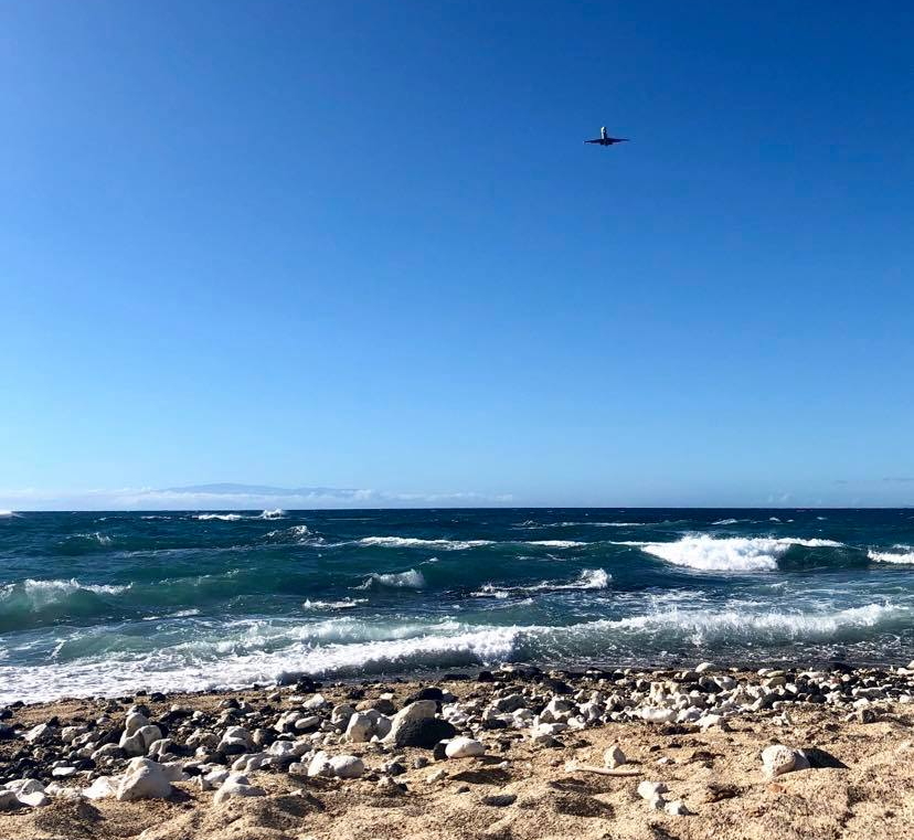
| Spot #4 – Beach – 17 Arrivals | |
|---|---|
| WHERE | It is very hard to shoot north of the airport in the afternoon, but the following spot is one of the best spots you can still reach quite easily. Turn off Queen Ka’ahumanu Highway to the west north of the airfield towards Kekaha Kai State Park/Beach. Take the bumpy road till the end/the beach (this may take up to 30 minutes as the road is very rough), park your car in the car park there and then walk to the westernmost point (the waterfront). |
| WHAT | Here you can only see aircraft arriving on runway 17, but these are still pretty high. However, this is the position which can be reached best on the afternoon side of the 17 approach path. |
| TIME | From later noon till sunset. |
| MISC. | The most important note is the road to get to that beach park… They’ve tried to carve it out of the lava rock, but it is extremely bumpy, do not take the road with sports and small cars! The section of road from the highway to the beach can take you up to 30-45 minutes because you have to drive so slow as it is extremely bumpy! Nothing around the beach/car park except some toilets. |
| FOCAL LENGTH | 200-400mm |

Turn off into this road here and drive till you reach…
…this beach parking. Park your car on the right behind the bushes as marked and proceed by foot to the beach…
…where your view should look like this:
Notes on spot 2: Great viewing area for aircraft taxiing to Runway 35 and/or arrivals on Runway 35. A bit harder to catch departures from 35. There is a trailer on the right side of the gravel parking lot in front of the helicopter buildings that you can stand on to spot. The helicopter pilots come through that area but don’t mind if you spot, when I went, they were open to me spotting and I had nice conversations with a few of them. Watch out for police because it is “illegal” to spot at Kona as I was told by an airport official, but I was there for 5 hours and only saw police 3 times. I just got in the car and they didn’t think anything of it. Morning light is impeccable.
Notes on spot 1: spotted there for a bit, it’s not only great for arrivals but also 35 Departures, as you can see aircraft taking off in front of mountains and then making a sharp bank off to the continental United States. Unfortunately, left my SD on the plane but the focal lengths are approximately (Nikon D750)
717 or smaller: 250mm for takeoff, 500+ for banking
737 or 321N: 180 for takeoff, 420+ for bank
A330/787-10: 100 for takeoff, 300 for bank.
Additionally, the terrain is kind of bad and does require some climbing to get to, so be careful with the rocks.
Thanks for the info Rohan and too bad that you lost your memory card 🙁
-Julian