


SAV-Spot1
Fliegerschiessen AXALP – Spotting Guide
September 27, 2020
Leeuwarden Air Base – Spotting Guide
October 2, 2020Fliegerschiessen AXALP – Spotting Guide
September 27, 2020Leeuwarden Air Base – Spotting Guide
October 2, 2020Savannah Hilton Head Airport – Spotting Guide
- last modified on December 5, 2023
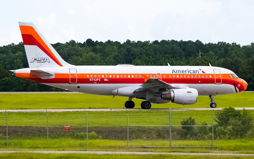
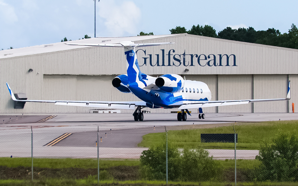
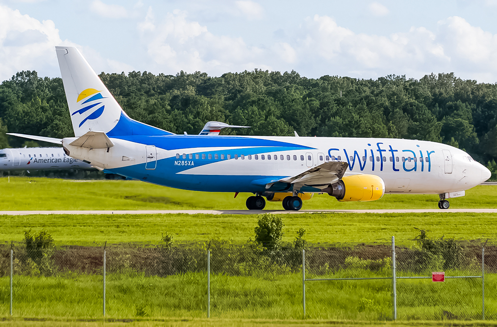
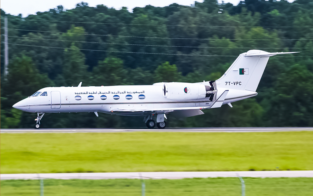
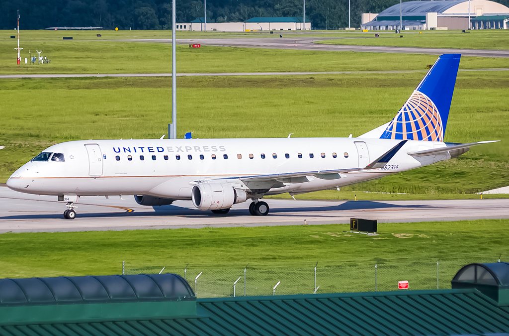
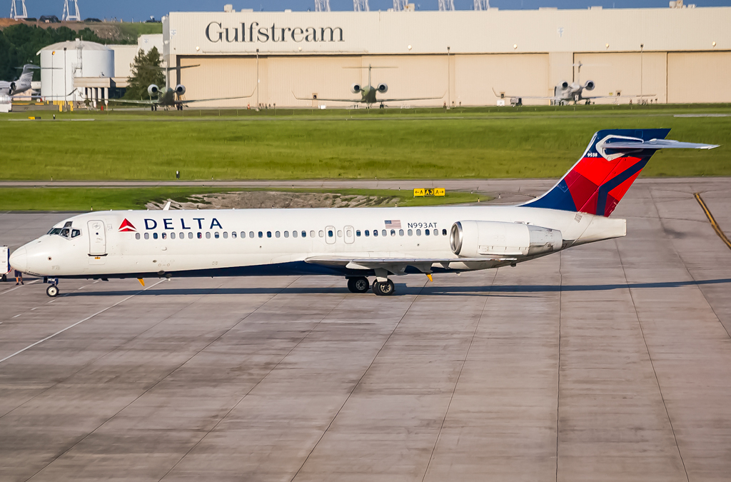
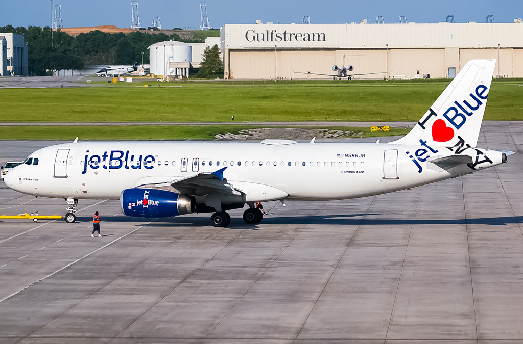
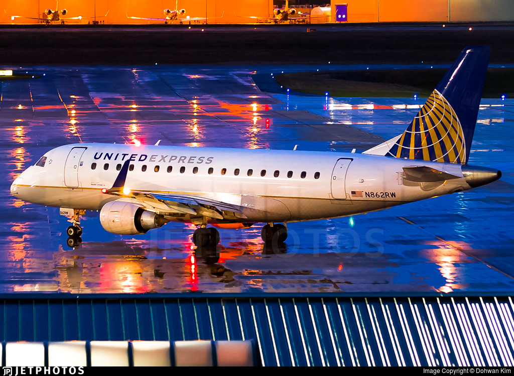
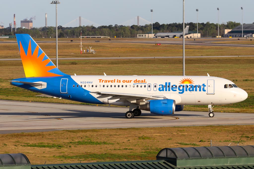
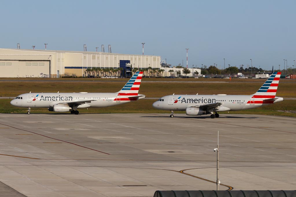
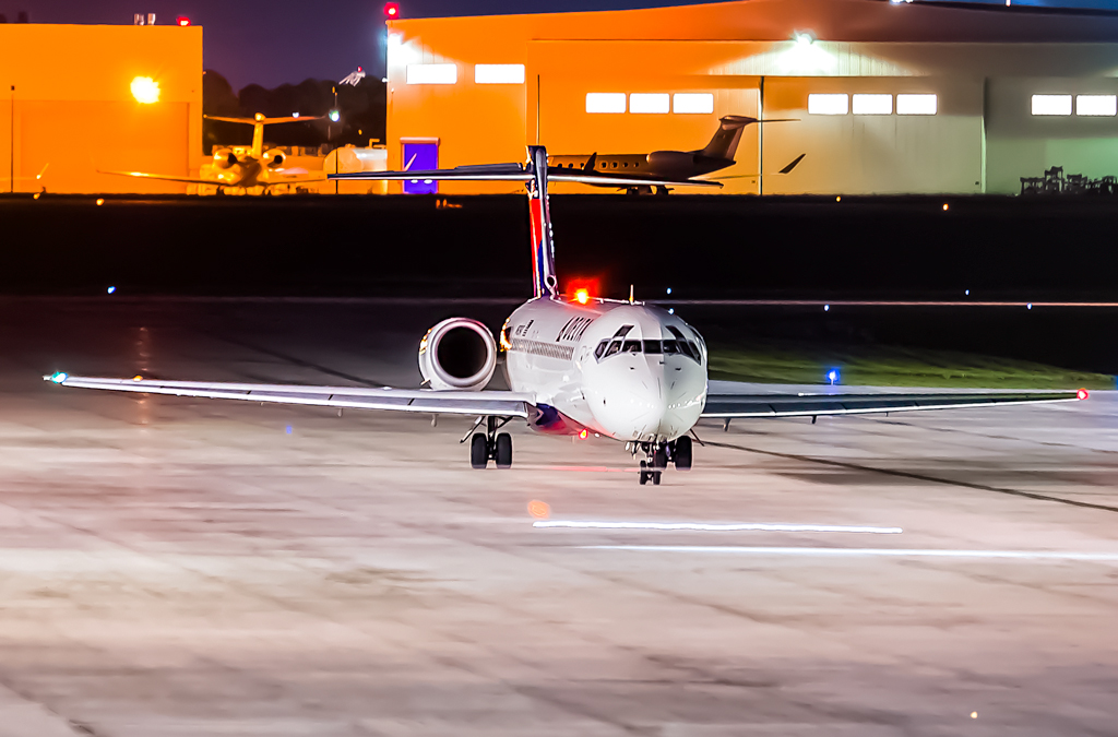
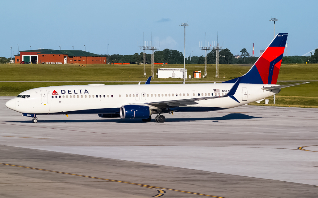
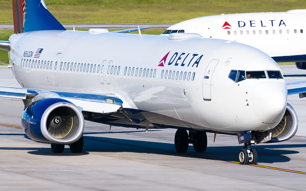
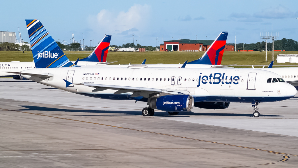
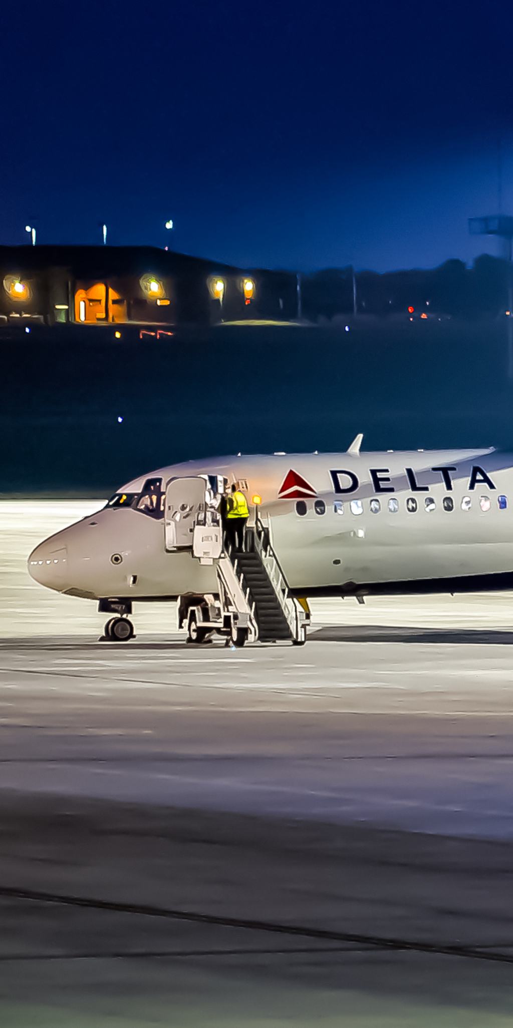
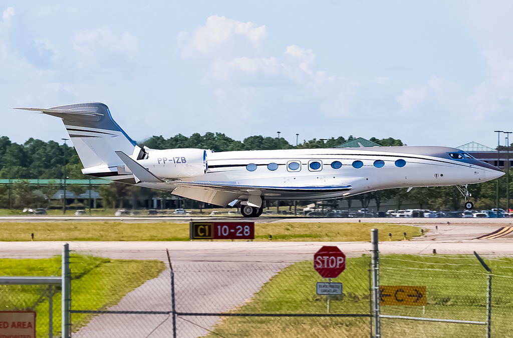
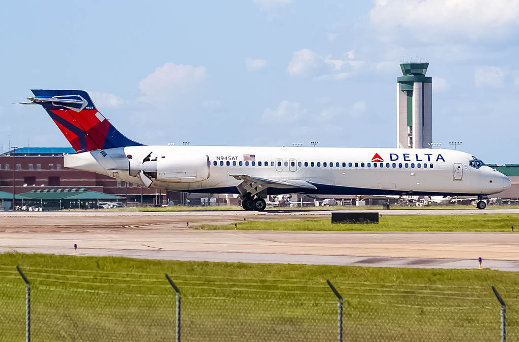
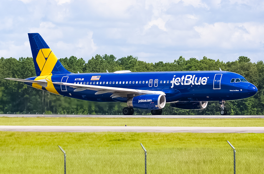
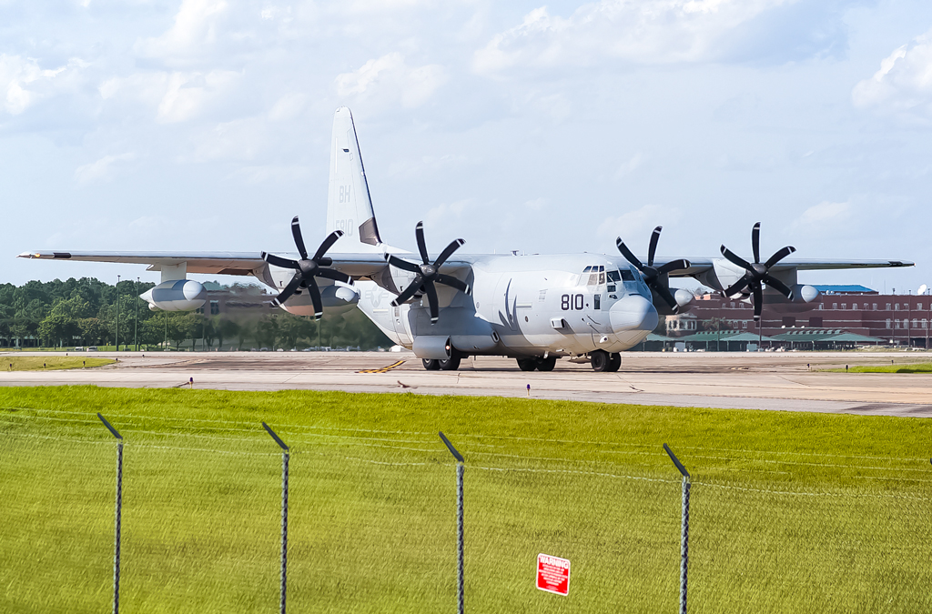
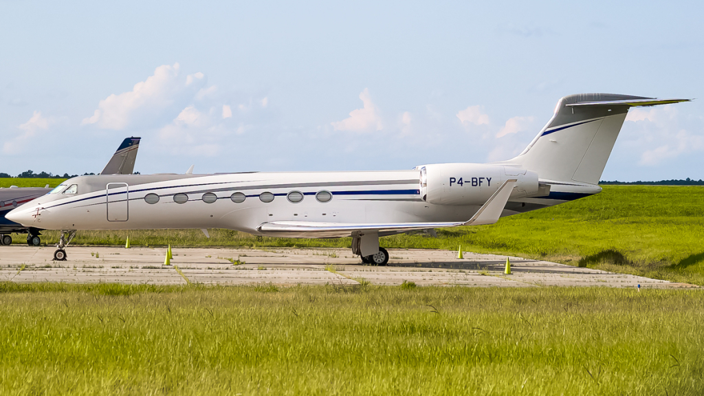
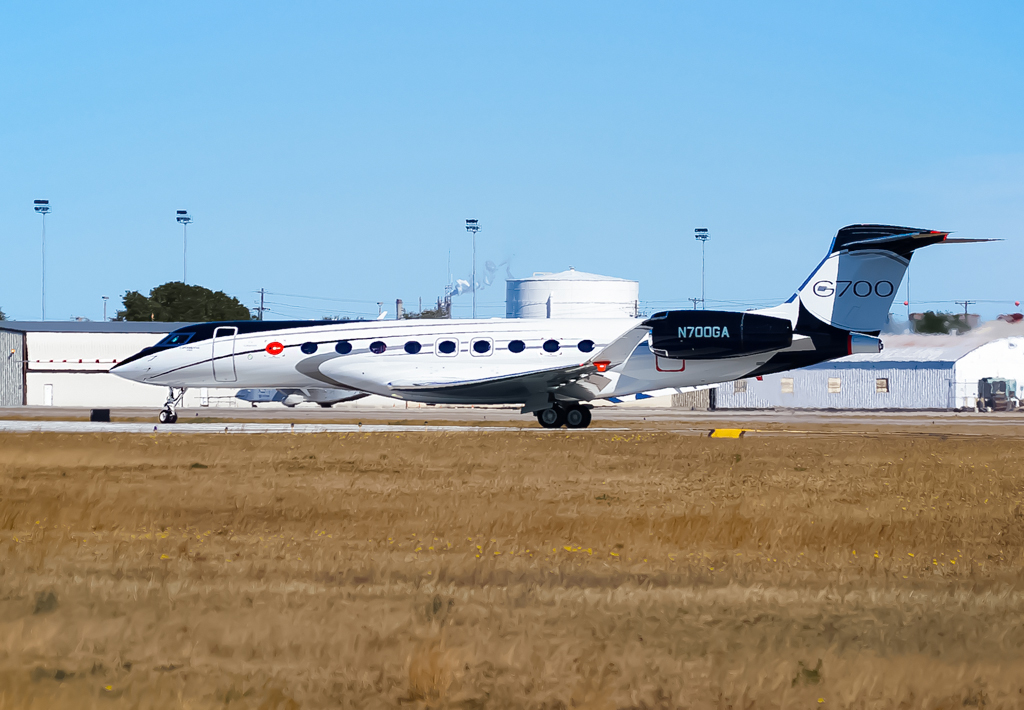
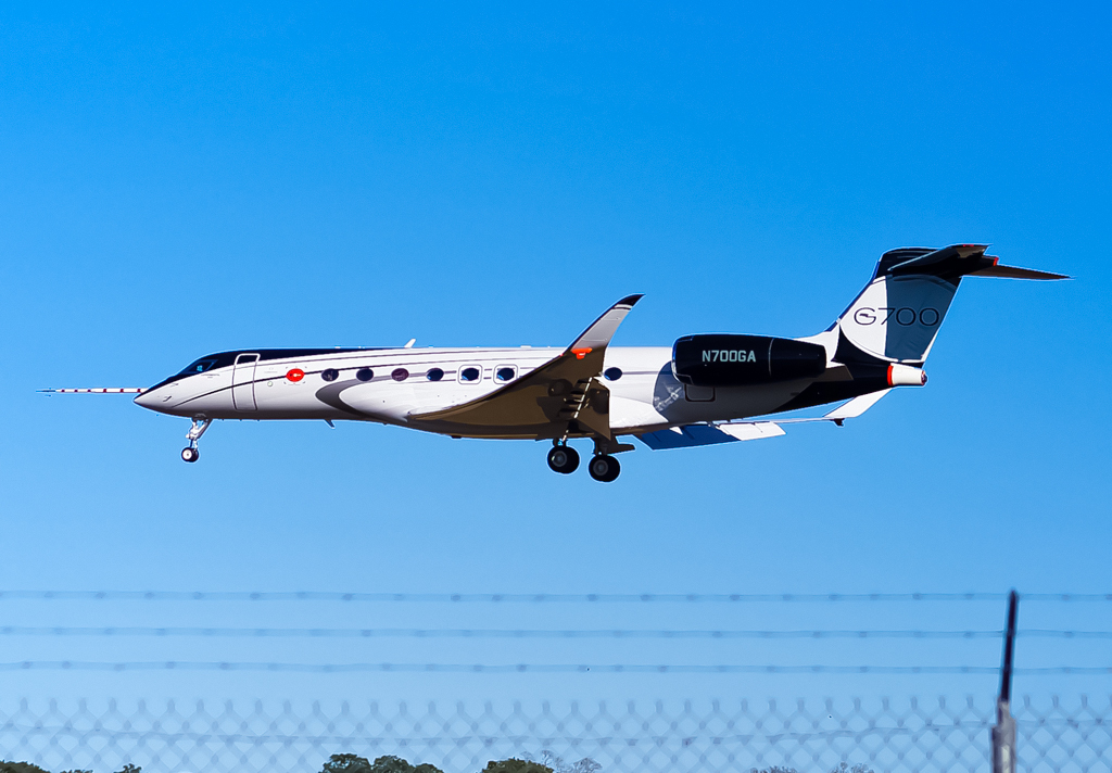
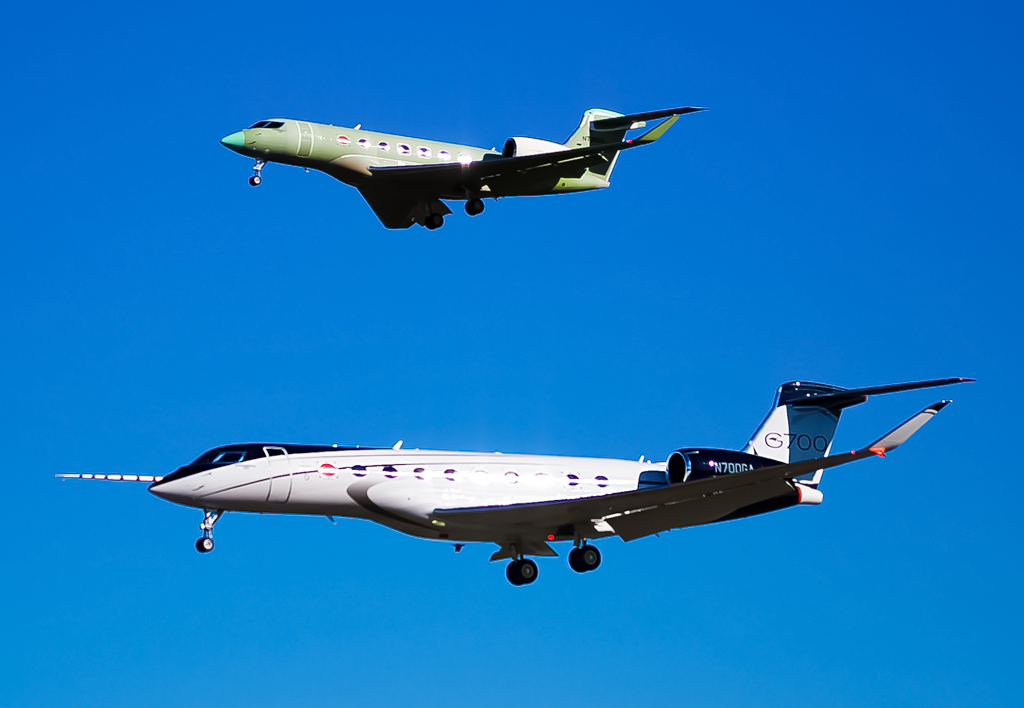
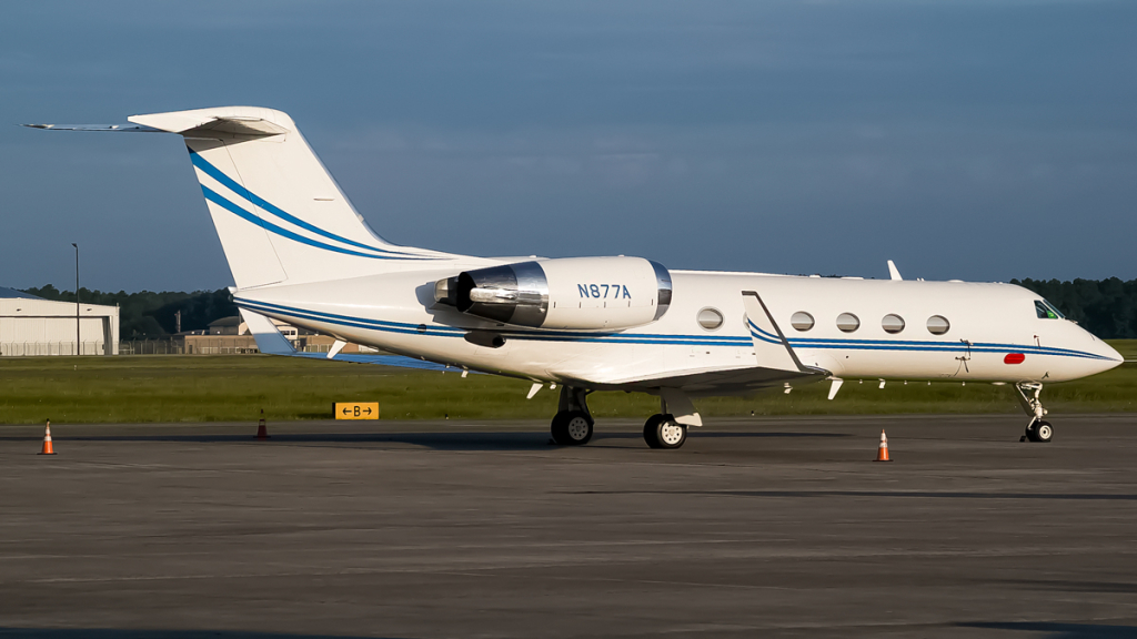
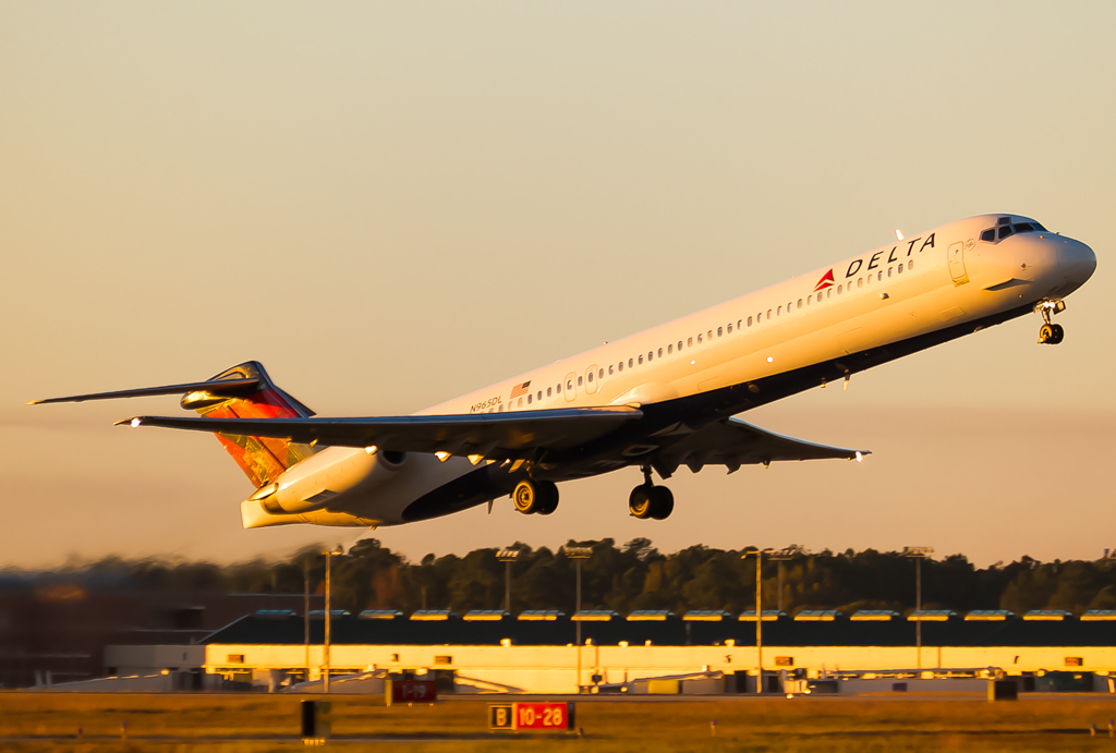
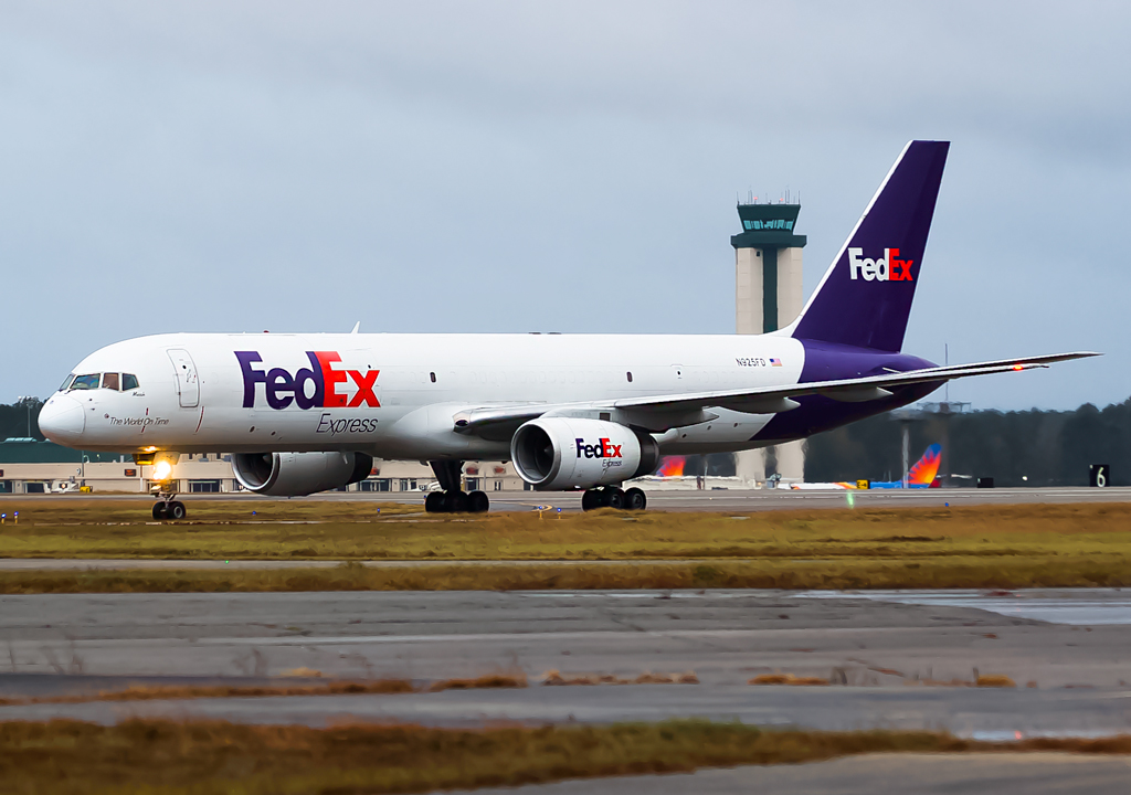
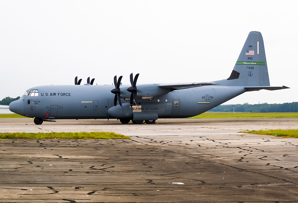
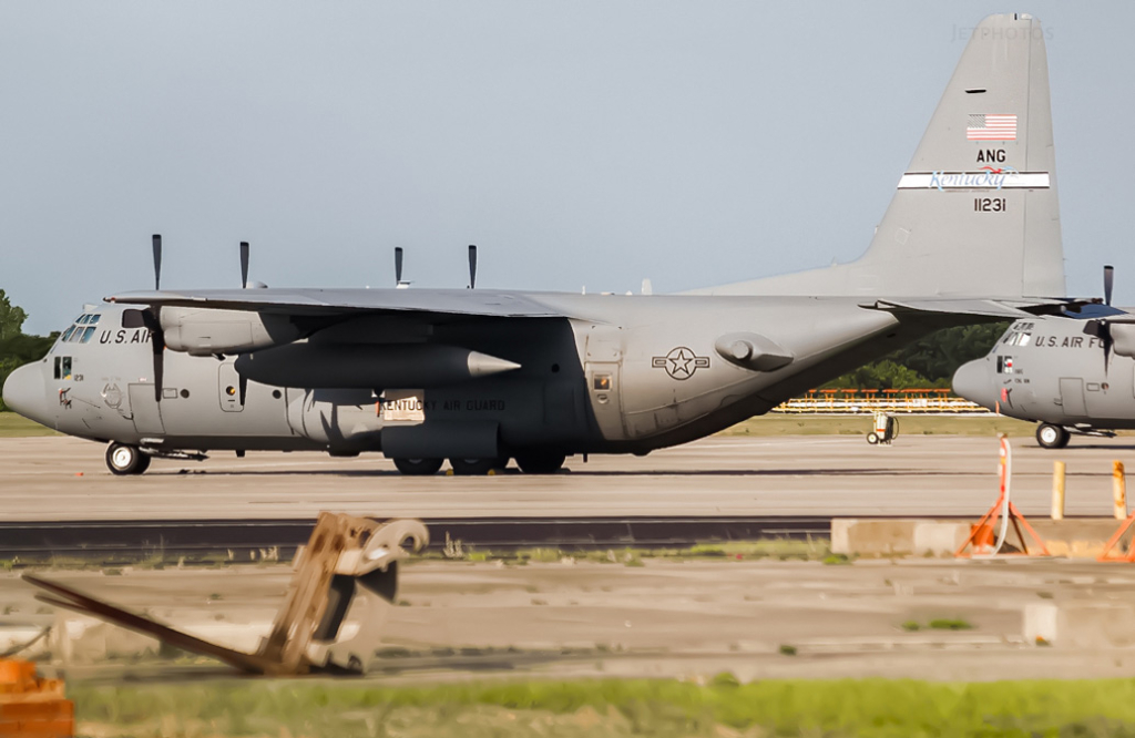
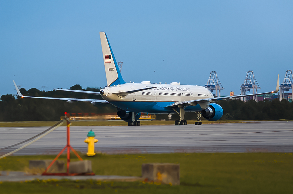
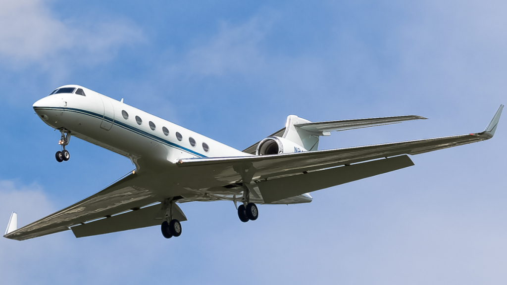
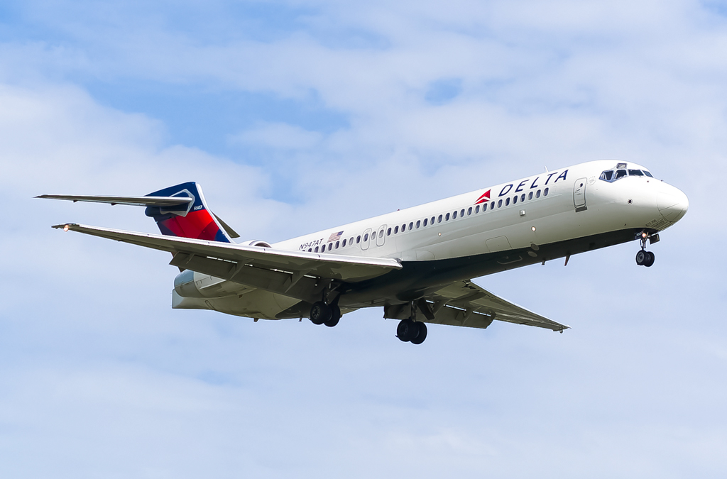
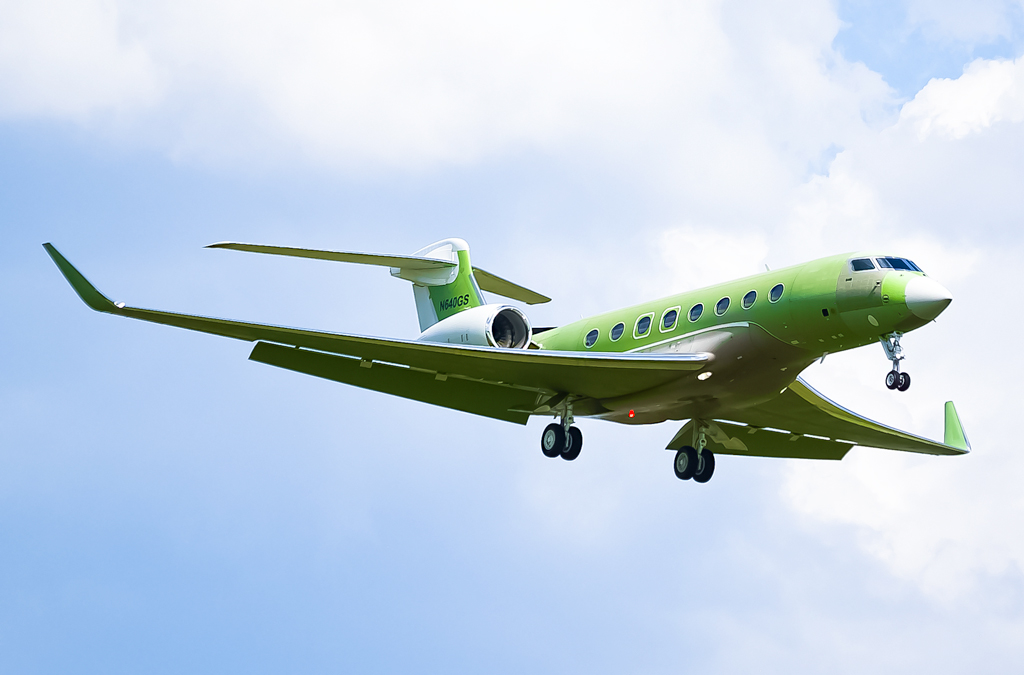
Savannah/Hilton Head International Airport (SAV/KSAV) is the second busiest commerical airport in the state of Georgia. It is home to Gulfstream Aerospace’s global headquarters and hosts its production/test facilities and service centers. Consequently, you will see a variety of private, corporate, government, and miitary Gulfstreams present. Main airlines are Delta, Allegiant, United, American, and JetBlue: SAV is a focus city for Allegiant. The Georgia Air National Guard’s 165th Airlift Wing, which operates C-130H Hercules transports, is present. Cargo operations are mainly seen with FedEx (Boeing 757) and UPS (operated by Air Cargo Carriers; Short 360).
Written by Dohwan Kim. Last Update: April 2022
| Rating | |
| Movements | |
| Airline Variety | |
| Photo Locations | |
| Weather | |
| Airport Information | |
| Runways | |
| 10/28 | (9351ft/2850m); concrete |
| 01/19 | (7002ft/2134m); concrete |
| Terminals | |
| North Side | Allegiant, American, American Eagle, Sun Country, Air Canada Express, Frontier, charters |
| South Side | Delta, Delta Connection, JetBlue, United, United Express, charters |
| Airport Chart |  |
| Spotting Information | |
| Ladder | Yes (not always recommended); spot #1 |
| Car/Public Transport | Car needed for all spots |
| Restrooms | Airport terminal or gas stations/fast food places |
| Drinks/Food | Airport terminal or gas stations/fast food places. Most regular restaurants are in nearby Pooler. |
| Hotels | Most hotels are in Pooler, which is right next to the airport. One (Days Inn), is next to the Air National Guard base. |
| Season | Spring and summer can present some heat haze and lighting issues. Fall has some awkward lighting. Winter is usually fine. Weather, especially in summer, can be unpredictable. |
| Security | Airport police and ops recognize spotting, although they may redirect you to offical spots (#1 and #2). Have your ID on you since they tend to check that to confirm that you’re only spotting and not doing anything else. Gulfstream security is less tolerant and will usually tell you to leave any areas close to the company’s facilities. Airport and immediate surrounding areas are typically safe. Do NOT photograph anything from Gulfstream property. |
| Runway Usage | |
| General Info | Runways 1/19 and 10/28 intersect at near 90 degree angles. Arrivals and departure patterns are generally predictable. If the winds are out of the east, the pattern will usually be landings and departures on 10 while it will usually be 28 for winds from the west. 1/19 is hit or miss and is mainly used by general aviation and business jet traffic, although Allegiant Air, FedEx, and American/American Eagle are also known to use this runway from time to time. You will rarely see any commercial and military traffic on 1/19. |
| 10/28 | Used all day by most airliners, military arrivals, general aviation, and business jets (arrivals and departures) |
| 01/19 | Mainly used all day by business jets and general aviation, although Allegiant and (occasionally) other airlines will use it too; arrivals and departures |
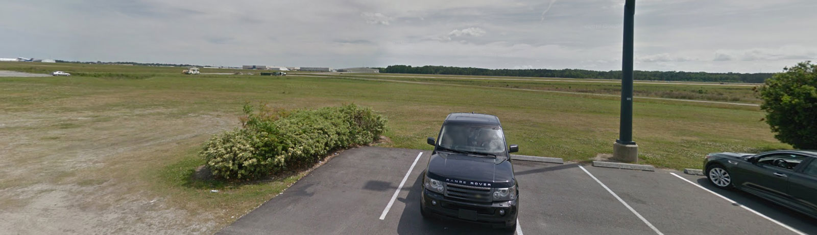
Cellphone Lot - 10/28 movements, taxiway E
| WHERE | If entering the airport via Airways Avenue, you will need to turn right at the intersection with Patrick S. Graham Drive. If entering via Patrick S. Graham drive, you will need to drive straight ahead. Once you have done this, you will be on Aggett Drive. Take the second right into the lot and find any available spots, preferably closest to the fence. If exiting from the terminal, go to the floor level of the airport, which is the rental car/pickup area. Make sure that you are walking in a southerly direction. Once out of the terminal, follow Aggett Dr. In all cases, you will see a sign that says “Cell Phone Waiting Lot.” If you have a car, stand on top in order to have a clearer vantage point due to the fence. A ladder shouldn’t hurt either. |
| WHAT | Overlooks Runway 10/28 and Taxiway E |
| TIME | Summer only (any time after noon/1:00 P.M.); heat haze can be a problem on certain days |
| MISC. | Terminal is nearby. However, you are not supposed to leave your vehicle unattended. This is an officially recognized spotting location and the police know this. |
| FOCAL LENGTH | 70-300mm for anything as big as or bigger than a G-IV; longer lens recommended for anything smaller |


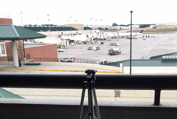
Hourly Parking Garage - Terminal ramp, taxiway E/F, runways
| WHERE | If entering the airport via Airways Ave, go straight. You will see the road split into 3 different lanes: stick to the left-most lane. You will see toll machines for your garage ticket. If entering the airport via Patrick S. Graham Dr, take a sharp left and follow Airways Ave. as described above. Once in the garage, you will get the best vantage points from the 4th level, although the 3rd could work too. No ladder required. |
| WHAT | Overlooks the terminal and ramps. On the south side of the garage, Delta, United, and JetBlue traffic is visible, as is the diversions ramp, Taxiways E and F, and distant views of Runway 10/28 and 1/19. Beware of the obstructions when facing Taxiway E/F and Runway 10/28. On the north side of the garage, Allegiant, American/American Eagle, Sun Country, and Frontier are visible. |
| TIME | After noon is best (all year round). |
| MISC. | Terminal is connected to the garage. All essentials (food, drinks, and restrooms) will be found in there. This is an official spotting location and the airport police know this. Parking fee is $1/hour. |
| FOCAL LENGTH | 70-300 for most aircraft on the ramp, longer lens recommended for airplanes at the end of the terminal and on Runways 1/19 and 10/28. |


Delta Ramp Overlook - ramp, taxiway F
| WHERE | Same directions for the previous spot. Walk out of the garage and get to the corner next to the terminal. |
| WHAT | Overlooks the south side of the passenger terminal, diversions ramp, and Taxiway F. |
| TIME | After noon is best (all year round). |
| MISC. | Airport police may request that you refrain from spotting at this spot since it’s not an official one. |
| FOCAL LENGTH | 70-300 |


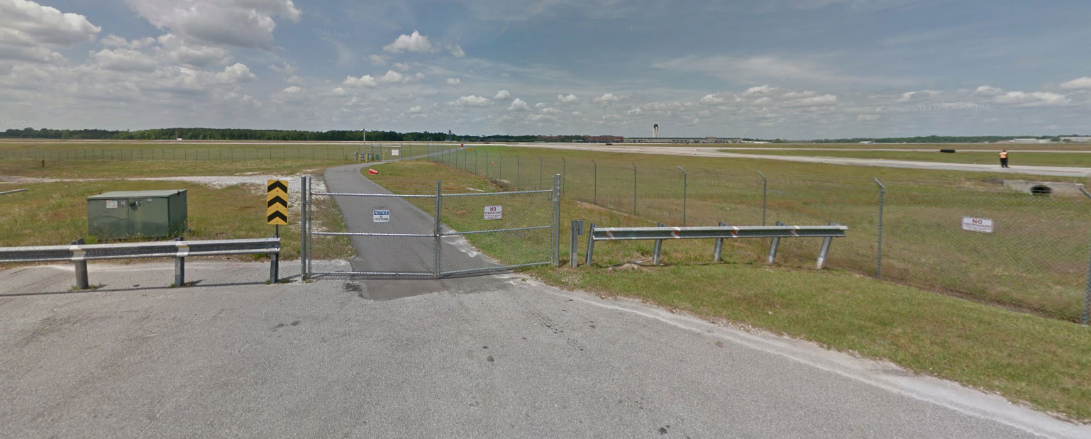
Product Support Road Roundabout - 10/28 movements, taxiway C
| WHERE | Follow the initial directions for the spot #11. However, you will proceed further down Dean Forest Road until you come to the intersection of Dean Forest Rd and Product Support Rd. Turn right onto Product Support Rd and go all the way up the road to the dead end. Ladder not recommended (stand on your vehicle, shoot your photos, and leave). This is technically a no stopping/standing zone, although you may see some Gulfstream employees parking here during breaks anyway. You will need to stand on top of your vehicle to clear the fence and a ladder is not recommended here. |
| WHAT | This spot overlooks Runway 10/28 and Taxiway C: it is directly across the airfield from the cellphone lot. |
| TIME | Summer: Sunrise to noon; Winter: Good almost all day; heat haze isn’ t too much of an issue |
| MISC. | Be discrete since Gulfstream’s private security will ask you to leave if they see you spotting. Take your shots, get back in your car, and leave. Additionally, do NOT take any photos at Gulfstream’s facilities since there are prominent signs saying “No Photography.”
No facilities nearby apart from the gas stations and fast food mentioned for the Runway 28 approach path spot. |
| FOCAL LENGTH | 70-300 is good for airliners and bizjets, general aviation requires a longer lens |


Sheltair - Ramp Overview
| WHERE | Same directions for the previous spot except that you’ll take a right onto Shirley B. James Drive. This is technically a no stopping/standing zone. Shoot through the fence and again, a ladder is not recommended here. |
| WHAT | Overlooks the ramp at the Sheltair FBO and Taxiway GA5. |
| TIME | Summer: Sunrise to noon; Winter: Good almost all day; heat haze isn’ t too much of an issue |
| MISC. | Be discrete since Gulfstream’s private security will ask you to leave if they see you spotting. Take your shots, get back in your car, and leave. Additionally, do NOT take any photos at Gulfstream’s facilities since there are prominent signs saying “No Photography.”
No facilities nearby apart from the gas stations and fast food mentioned for the Runway 28 approach path spot. |
| FOCAL LENGTH | 70-300, longer lenses may be needed for smaller general aviation aircraft |

Product Support Road - 01 arrivals
| WHERE | Same direction as the previous one it is just at the beginning of 01. This is technically a no stopping/standing zone. Pull over where the fence is lowest, get on top of your vehicle, take your shots, and leave. Again, a ladder is not recommended here. |
| WHAT | Overlooks Runway 1 as well as its approach path and part of the cargo ramp. |
| TIME | All day for Runway 1 (just switch between different sides of the runway). Cargo ramp is backlit until after 1-2:00 P.M. |
| MISC. | Be discrete since Gulfstream’s private security will ask you to leave if they see you spotting. Additionally, do NOT take any photos at/of Gulfstream’s facilities since there are prominent signs saying “No Photography.”
No facilities nearby apart from the gas stations and fast food mentioned for the Runway 28 approach path spot. |
| FOCAL LENGTH | 70-300 for most traffic, general aviation usually requires a longer lens |


Signature FBO - ramp, taxiway B, runway 1/19
| WHERE | Follow the initial directions for the spot #11. However, you will proceed further down Dean Forest Road until you come to the first exit at Davidson Road, across from the Days Inn/Hercules Bar and Grill. Once you turn right onto Davidson Rd, proceed straight ahead and make a left onto Bob Harmon Rd. From there, you will enter the Signature FBO parking lot. While a ladder isn’t recommended, a step stool will suffice in getting shots over the fence. Try to be discrete and take your photos when few/no ground crew are around since you may be asked to refrain from photographing tail numbers or asked to leave. I haven’t had issues with airport police or any other security here apart from the ground crew but be alert. |
| WHAT | Overlooks the Signature FBO ramp and part of Taxiway B and Runway 1/19. Gulfstream’s main service center is also visible, although individual aircraft over there will be difficult to photograph due to the distance and heat haze. |
| TIME | Sunrise to around 1-2:00 P.M (times aren’t exact). Heat haze shouldn’t be too much of an issue unless you’re photographing traffic on 1/19 or beyond. |
| MISC. | Try to be discrete and take your photos when few/no ground crew are around since you may be asked to refrain from photographing tail numbers or asked to leave. I haven’t had issues with airport police or any other security here apart from the ground crew but be alert.
No facilities nearby apart from the gas stations and fast food mentioned for the Runway 28 approach path spot. |
| FOCAL LENGTH | 18-55 or less for aircraft closer to the fence, 70-300 or more for aircraft closer to Taxiway B or beyond |


Cargo Sorting Facility - ramp, taxiway B, runway 1/19
| WHERE | When you leave the Signature FBO parking lot, take a right at the stop sign. Proceed down the road until you come across the DHL Express ServicePoint parking lot and take a right. Ladder not recommended. |
| WHAT | Overlooks part of the cargo ramp, Taxiway B, and Runway 1/19. No facilities nearby apart from the gas stations and fast food mentioned for the Runway 28 approach path spot. |
| TIME | Sunrise to around 1-2:00 P.M (times aren’t exact). Heat haze shouldn’t be too much of an issue unless you’re photographing traffic on 1/19 or beyond. |
| MISC. | Try to be discrete and take your photos when nobody is around since you may be shooed off by facility employees. I personally haven’t had any issues but be alert. |
| FOCAL LENGTH | 70-300 |

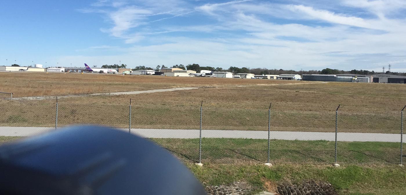
Runway Intersection Overview - all runways, taxiway B/C
| WHERE | Same initial directions forFBO (spot 7). Instead of turning left onto Bob Harmon Rd., keep going straight until the road makes an abrupt left. After you turn, proceed down the road and take a right at the stop sign. Park at the Civil Air Patrol squadron building (identifiable with the fence and gate). Do not block the gate. Ladder not recommended (use a step stool or something similar to shoot over the fence). This spot is located in the grass across from the end of the road. |
| WHAT | Overlooks the intersections of Runway 1/19 and 10/28 as well as Taxiways B and C. |
| TIME | For Runway 1/19 and Taxiway B, refer to spots #6 and #7. For Runway 10/28 and Taxiway C, all day. There may be issues with heat haze for some traffic on 10/28. |
| MISC. | Try to be discrete. While there is little vehicle traffic here for the most part, airport police and/or operations come around for periodic checks. The police and ops know what planespotting is but they may ask you to leave since this isn’t an official spot. Also be aware that aircraft like C-130s, KC-135s, C-17s, and others park in front of the fence from time to time. As such, Runway 1/19 and Taxiway B views may be obstructed.
No facilities nearby apart from the gas stations and fast food mentioned for the Runway 28 approach path spot. |
| FOCAL LENGTH | 70-300 for most traffic, smaller business jets and general aviation traffic on Runway 1/19 and Taxiway B will require a longer lens |


Air Dominance Ramp Overview - taxiway C, ramp
| WHERE | Directly across the road from previous location. Fence present, ladder not recommended. |
| WHAT | Overlooks part of Taxiway C and the Air Dominance Ramp. |
| TIME | All day for traffic on Taxiway C. Afternoons for aircraft on the Air Dominance Ramp. |
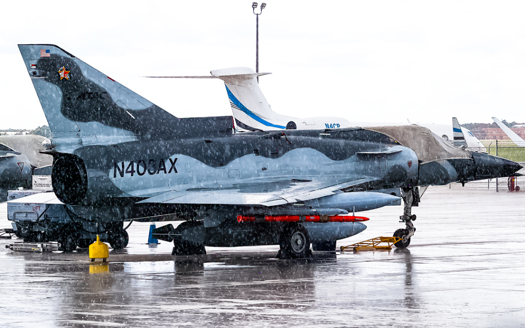
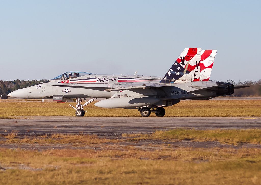
| MISC. | Try to be discrete. This spot has become a little more sensitive in recent years, especially since aircraft like F-22s deploy to Savannah for exercises from time to time. I haven’t been directly confronted by airport/military police or anyone else but please be alert. There may be plastic roadblocks stacked up as a barrier or miscellaneous vehicles parked closer to the fence when certain operations are occurring. F-16s, F-15s, F-22s, F-35s, C-17s, C-130s, KC-135s, C-5s, C-135FRs, Mirage 2000Ds, C-32As, L-159s, and other aircraft have been observed here. Shoot through the fence only. If asked to leave, comply.
No facilities nearby apart from the gas stations and fast food mentioned for the Runway 28 approach path spot. |
| FOCAL LENGTH | 70-300 for most traffic, longer lenses needed for aircraft parked further along the ramp |


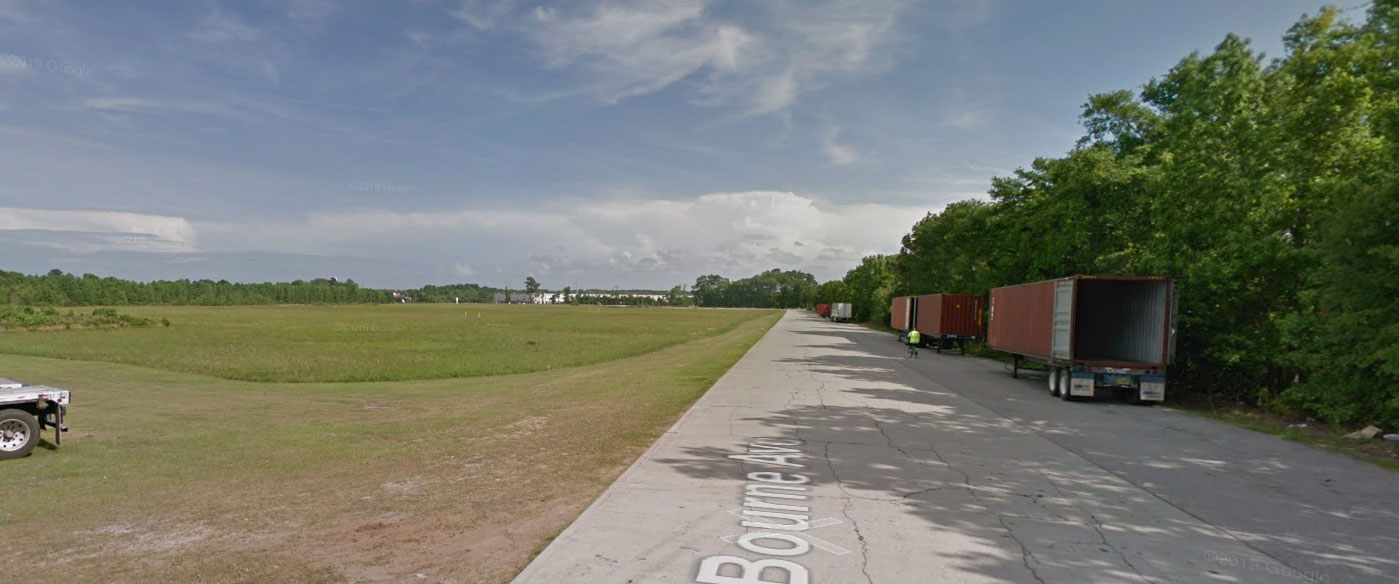
Bourne Avenue - 28 arrivals
| WHERE | Unfortunately, this location is no longer accessible as the owner of the property has closed it off. |
| WHAT | |
| TIME | |
| MISC. | |
| FOCAL LENGTH | |


 ,
,
Spot 11 is accessible again. Went there a few weeks ago with no issues
Uupdate: spot 11 is now closed off since the property owner shut it down due to truck drivers ditching their trailers there. Spot 5 is also problematic since the latest Sheltair FBO manager hates spotters.
Thank you for the feedback, guide has been updated accordingly.
Thomas
– spotterguide.net crew –