


LSMM-SPOT1
Trivandrum Intl. Airport – Spotting Guide
April 15, 2017
Santa Cruz Viru Viru Airport – Spotting Guide
April 19, 2017Trivandrum Intl. Airport – Spotting Guide
April 15, 2017Santa Cruz Viru Viru Airport – Spotting Guide
April 19, 2017Meiringen Air Force Base – Spotting Guide
- last modified on November 21, 2023
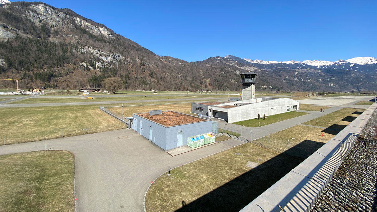
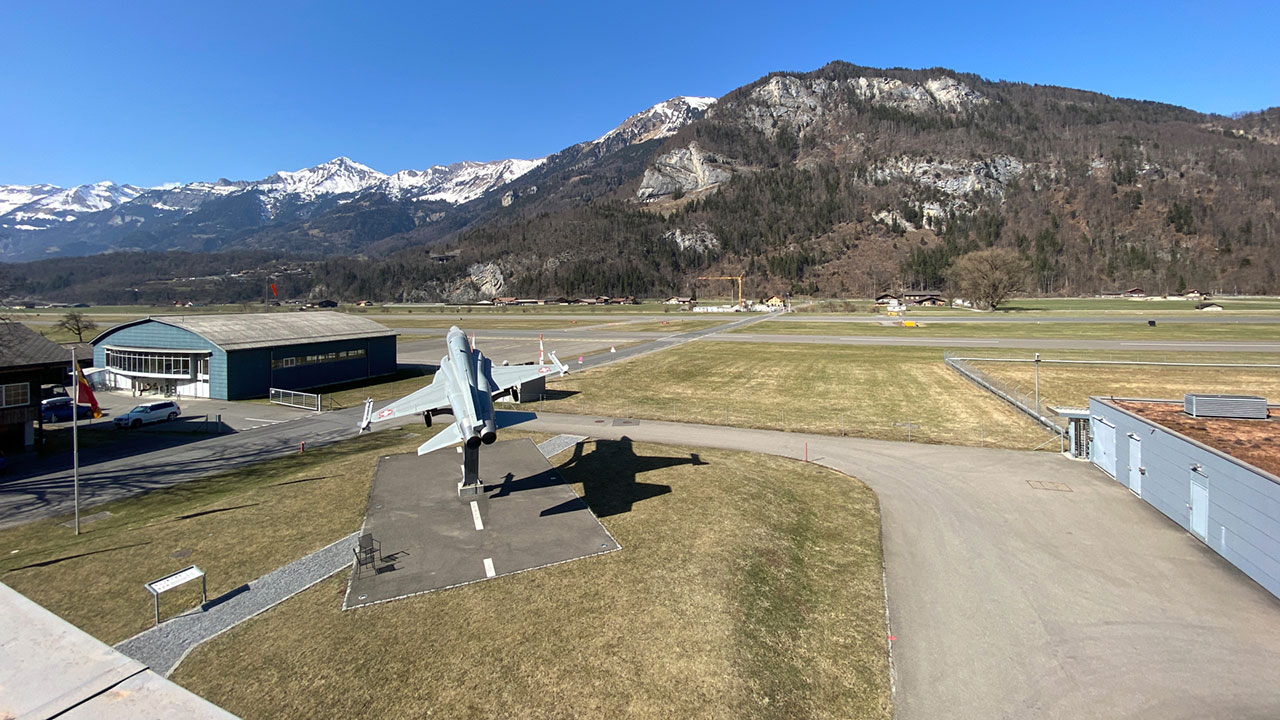
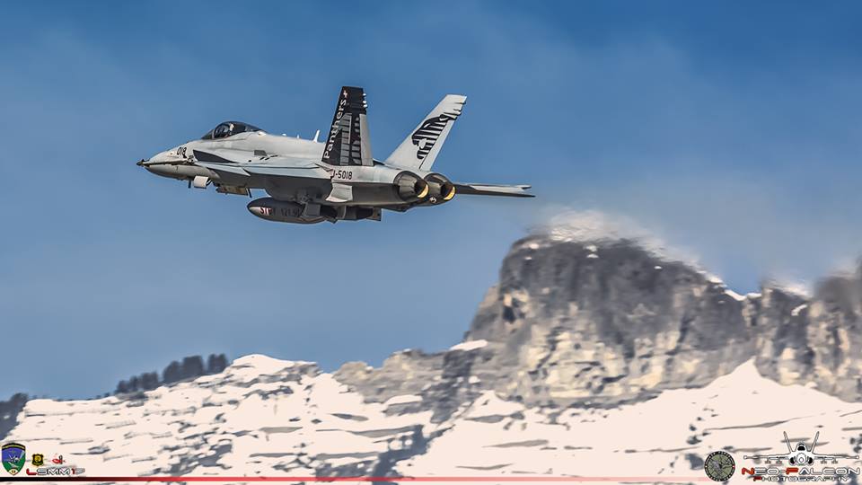
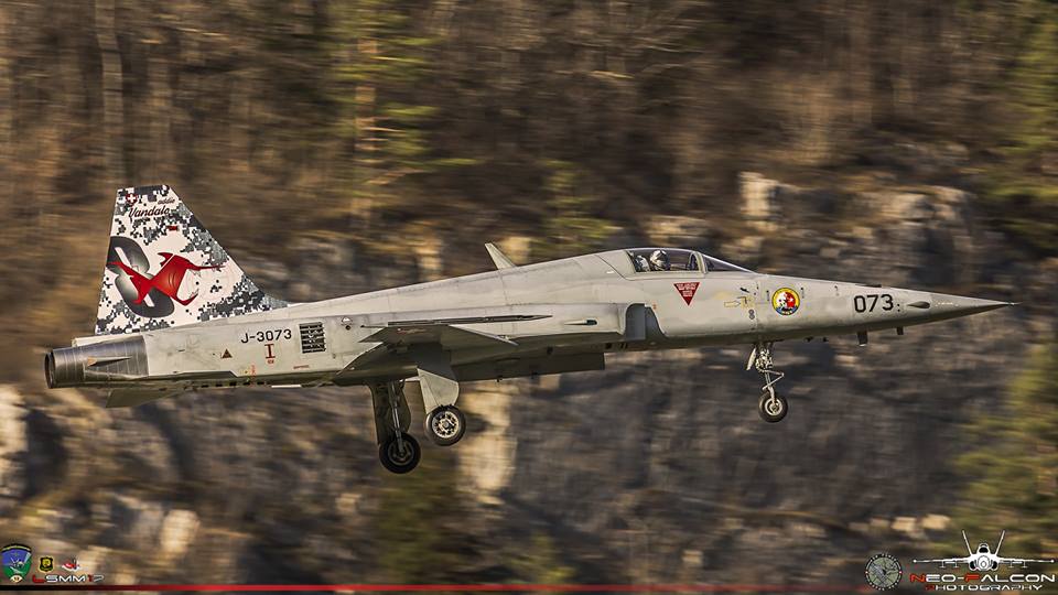
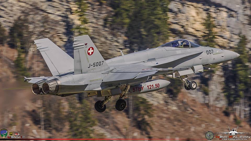
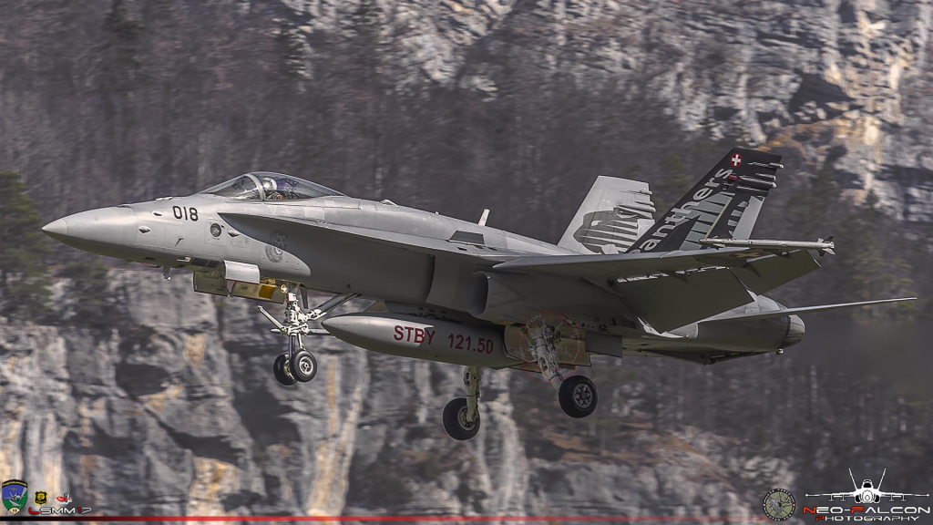
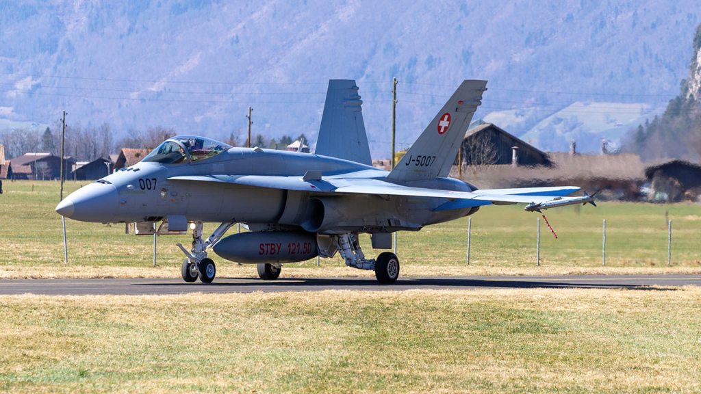
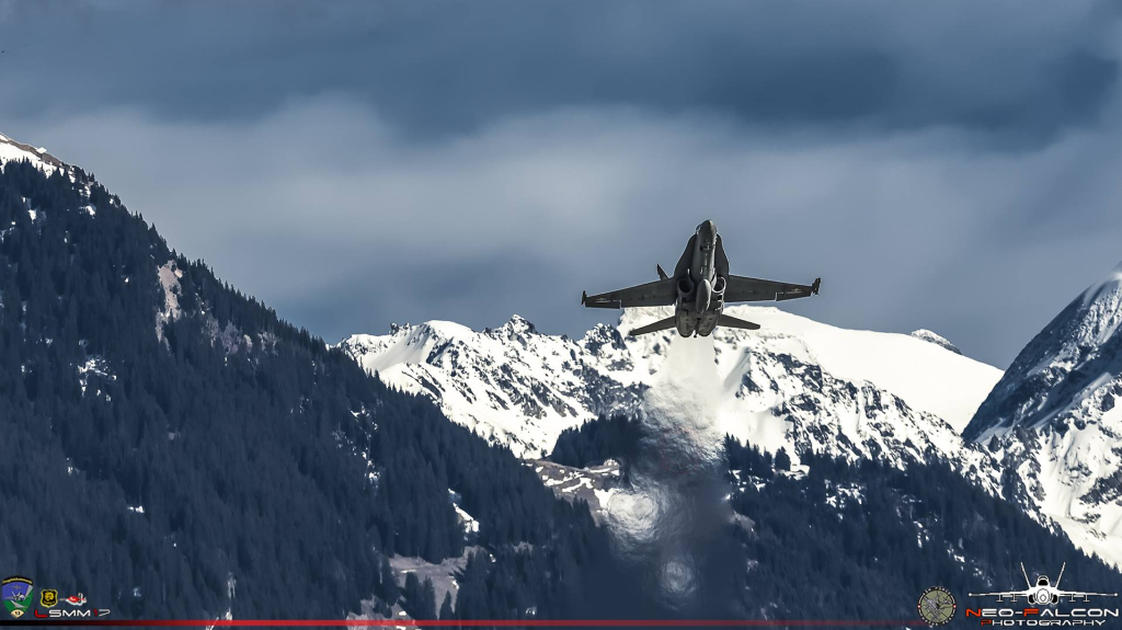
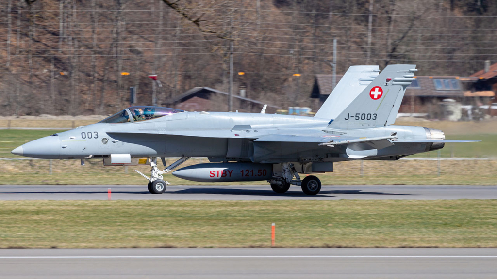
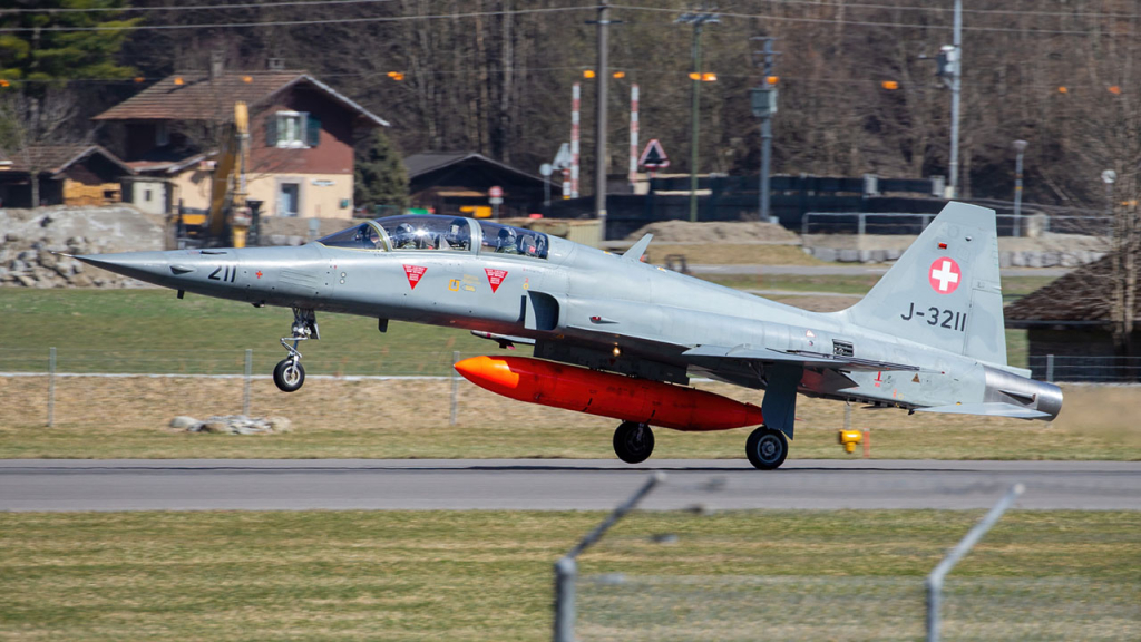
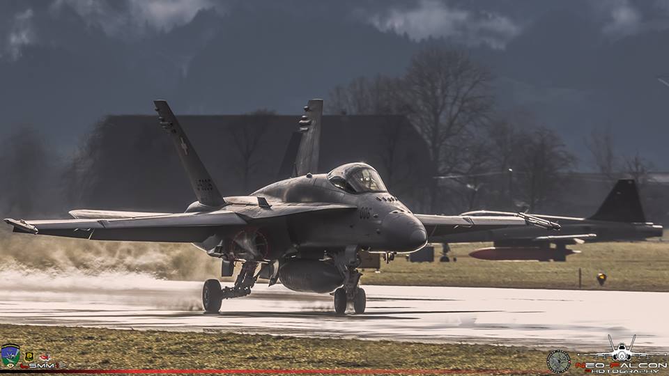
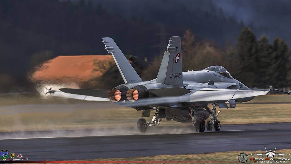
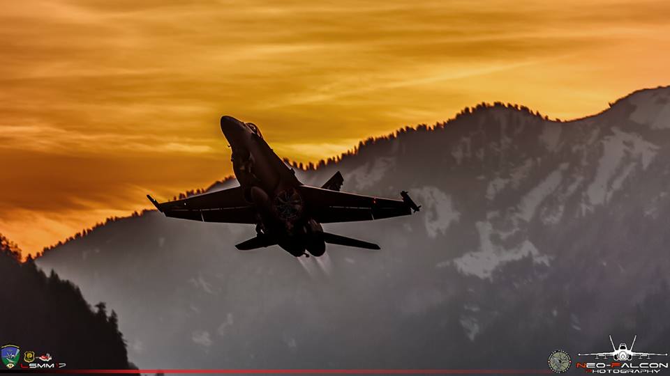
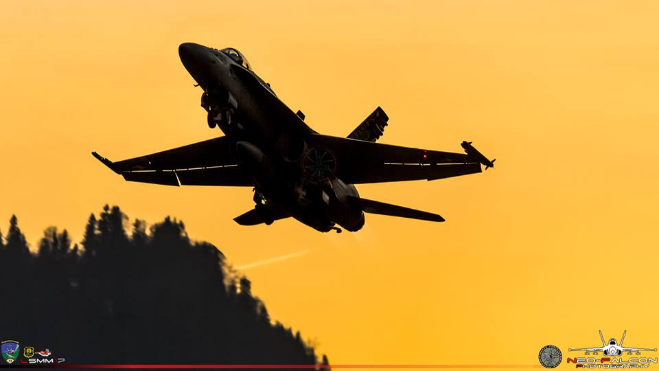
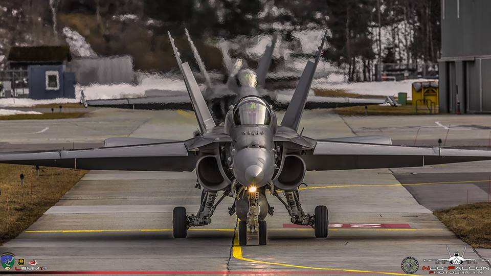
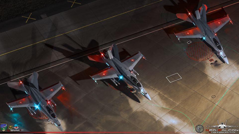
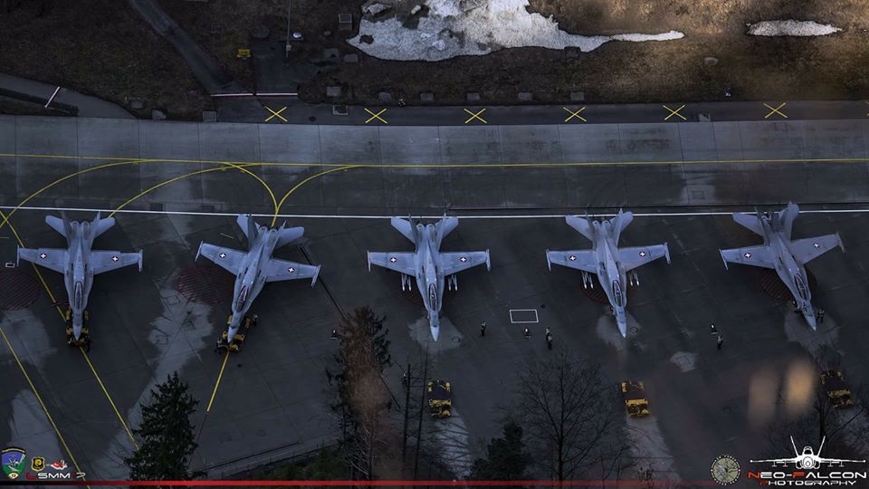
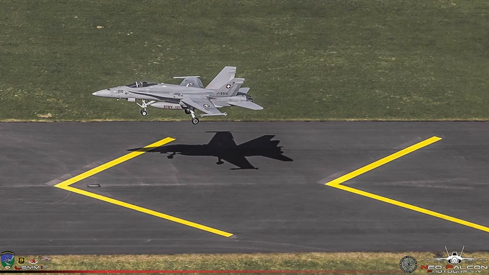
Meiringen Air Base (ICAO: LSMM), is located in the state of Bern. The airport is only used by the Swiss military air force and it’s the second busiest military stations in Switzerland. LSMM is also the only Swiss airbase that uses an aircraft cavern in daily operations. The runway is equipped with retractable arresting gear devices which is mainly used by the FA18 Hornets at some times.
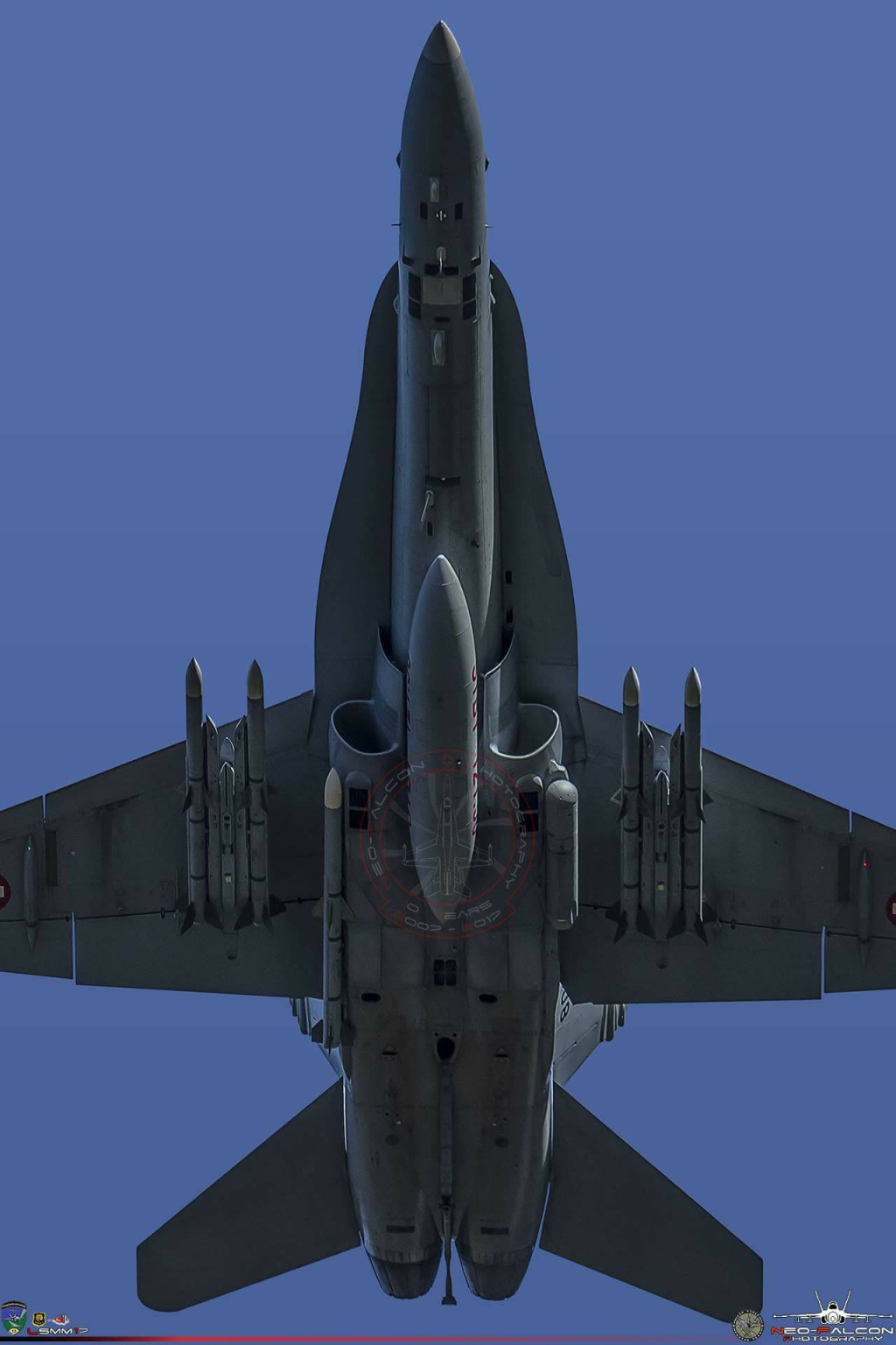
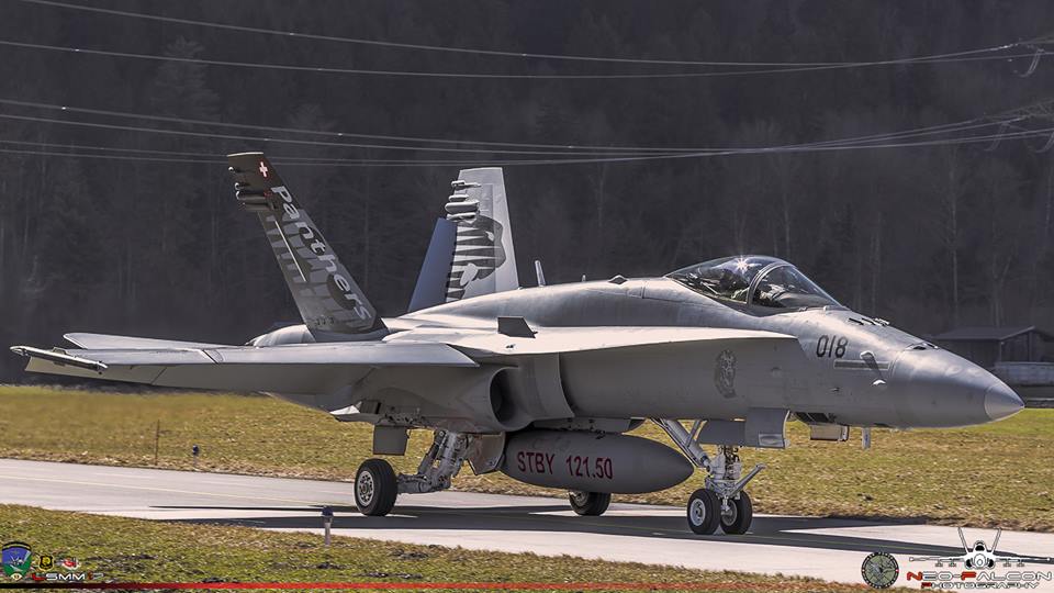
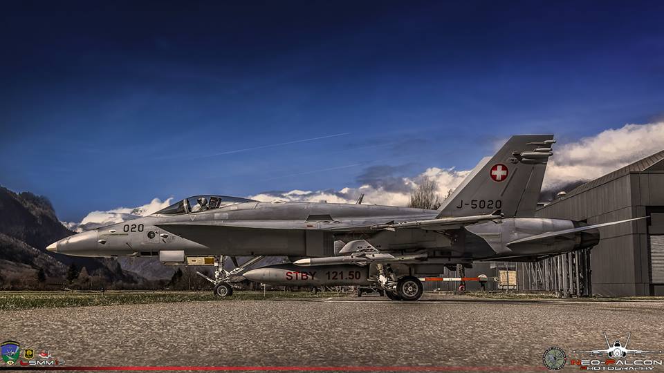
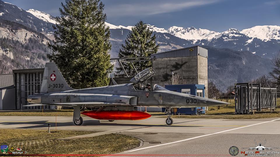
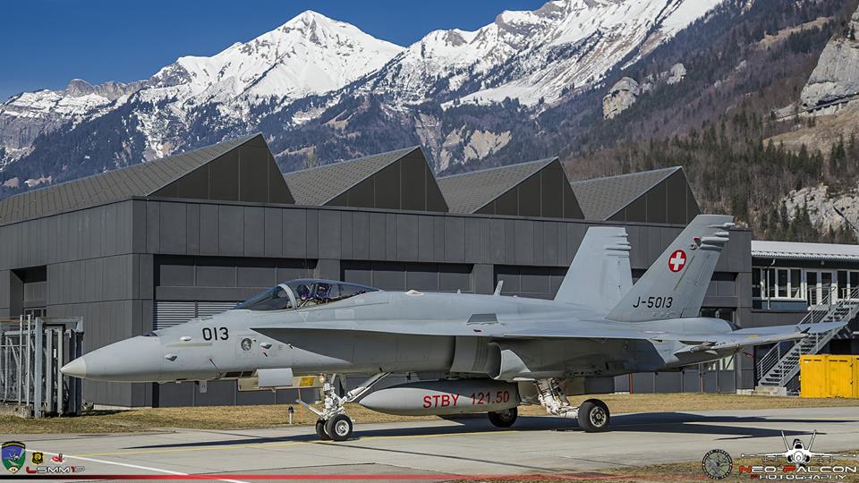
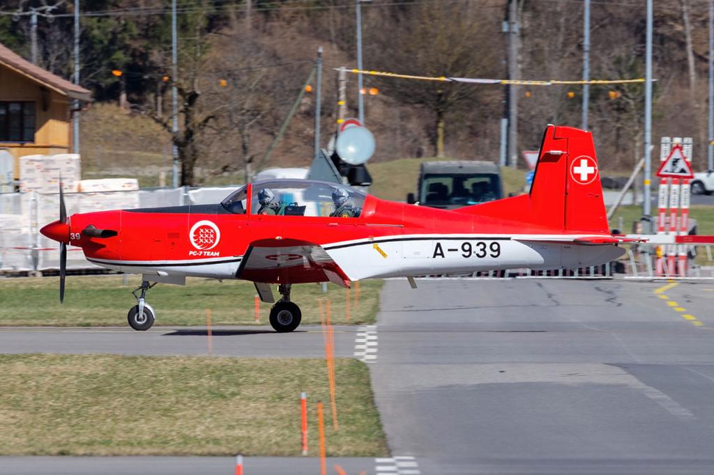
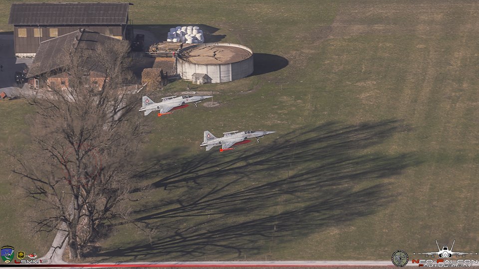
The traffic is mainly concentrated on FA18 Hornets and F5 Tigers. It is the home base to two fighter squadrons, militia Squadron 8 “Destructors”, equipped with the F5 Tigers and professional Squadron 11 “Tiger” equipped with the FA18 Hornets. The airfield has a small museum that is open on Wednesday afternoons from May to October.
The use of a airband scanner is tolerated and the frequency for the tower is 130.150 MHz.
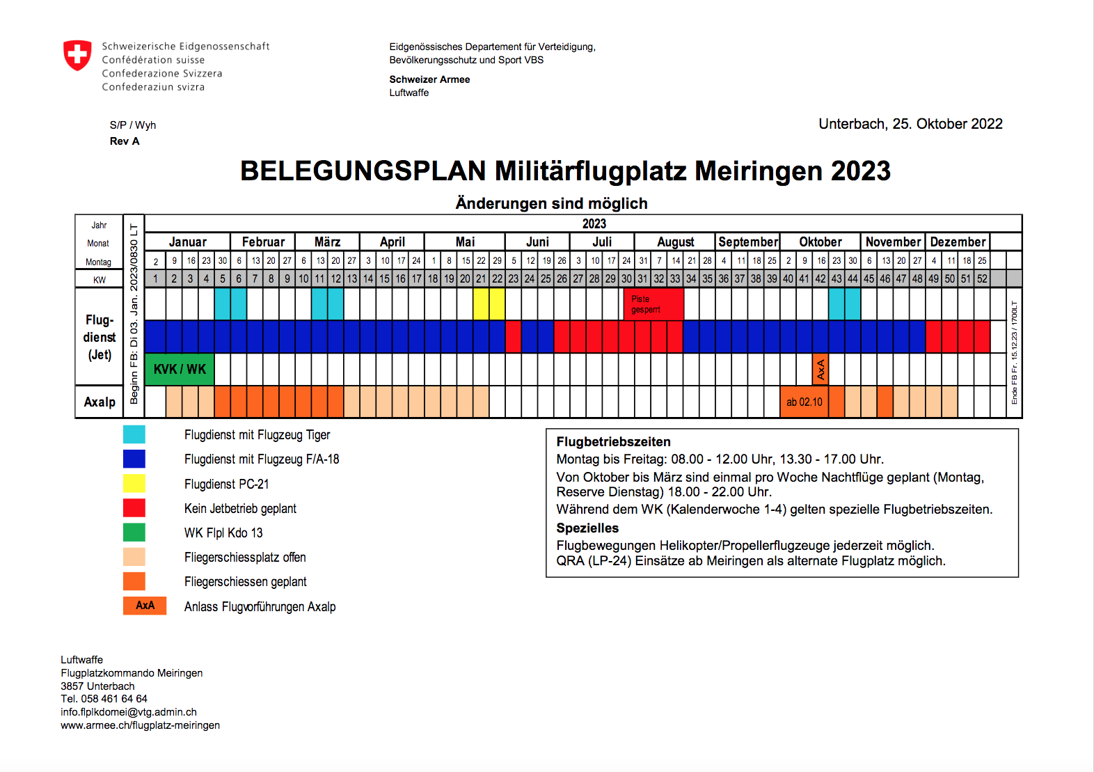
The 2022 flights services from the Swiss Air Force at LSMM can be find below (not available in English):
Written by Jeremy Denton and Stefan Bratner. Pictures by Neo-Falcon Photography. (Last update 2023).
| Rating | |
| Movements | |
| Photo Locations | |
| Weather | |
| Airport Information | |
| Runways | |
| 10/28 | 2,003m (6,571ft) Asphalt |
| Spotting Information | |
| Ladder | There is no need for it |
| Car/Public Transport | Car is recommend but there is a bus which runs from the Meiringen train station to the airport hourly. |
| Drinks/Food/Restrooms | Available at the Restaurant “Fliegertreff” at the airport. |
| Hotels | Few hotels could be found next to the airport, many villages or small city are nearby. |
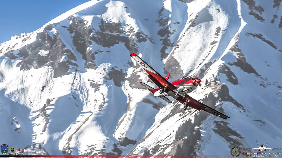
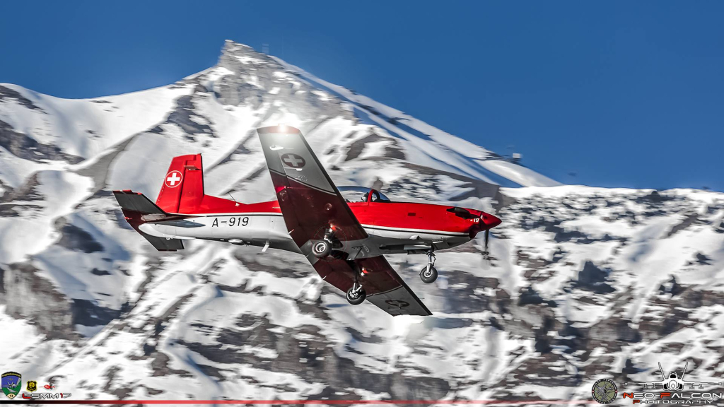
| Season | The best season is during winter time as you get some fantastic background shots with the snow on the mountain. Otherwise summer to get more chance on the sun. |
| Security | We recommend you to take some ear protection as you are pretty close from the jets and to respect the signs and the environment. People are really friendly even security AF but if you don’t respect the rules, the Air Base Security Soldiers will come to move you pretty quickly. |
| Runway Usage | |
| 10/28 | Depends on the wind direction. |
| Spot #1 – Runway 28 (approach) | |
|---|---|
| WHERE | From Meiringen Base, follow the road “Balmstrasse” until you cross the taxiway of the fighters where they come from the cave and a few hundred meters you will see some houses where you can park the car next to the road on the grass. Try to park your car on the best way possible. |
| WHAT | Good location to get arrivals shots on runway 28. |
| TIME | All day in winter. Not early morning/evening in summer. |
| MISC. | Nothing nearby so take what you need before coming at this spot. |
| FOCAL LENGTH | 200-300mm |


| Spot #2 – Cave taxi way | |
|---|---|
| WHERE | This spot is located directly at the Air Base. Park your car at the official visitor parking of the airport and then walk direction runway 28 along the road until you reached the cross road from the cave to the runway. Stay on the side of the road and not on the field. |
| WHAT | Taxiing aircraft from the cave to the runway and conversely. |
| TIME | Mostly all day. |
| MISC. | Nothing nearby so take what you need before coming at this spot. |
| FOCAL LENGTH | 18-105mm |


| Spot #3 – The House | |
|---|---|
| WHERE | From the public parking, drive in the opposite direction of the spot2 on “Guntlerey” road until you reached a small house next to the road. Park your car at the nearby shelter and walk back. But do not park on the taxiway as it is still active! |
| WHAT | Arrivals and departures both runway directions and taxiway Gulf movements. |
| TIME | All day in winter. Not early morning/evening in summer. |
| MISC. | Nothing nearby so take what you need before coming at this spot. |
| FOCAL LENGTH | 200-300mm |


| Spot #4 – Runway 10 Cross Way (South) |
|
|---|---|
| WHERE | From the spot 3, continue on the same road and same direction. Once you are at the “Waldey” intersection park your car on the left side of the road next to the farmer house (refer to the map). Then walk a few minutes towards the spot. |
| WHAT | Good for arrivals runway 10 but you can also have shots of departures from rwy28. |
| TIME | All day in winter. Not early morning/evening in summer. |
| MISC. | Nothing nearby so take what you need before coming at this spot. |
| FOCAL LENGTH | 200-300mm |


| Spot #5 – Runway 10 Cross Way (North) |
|
|---|---|
| WHERE | From spot 4, just continue driving and cross the runway then on your left you’ll notice a small white building it’s here that you have to park the car (not much available space, 2 places). Then walk towards the horse field. |
| WHAT | Good for arrivals runway 10 but you can also have shots of departures from rwy28. |
| TIME | Early morning in Summer, no good during winter time. |
| MISC. | Nothing nearby so take what you need before coming at this spot. |
| FOCAL LENGTH | 200-300mm |


| Spot #6 – Barrier/Runway 28 Cross Way |
|
|---|---|
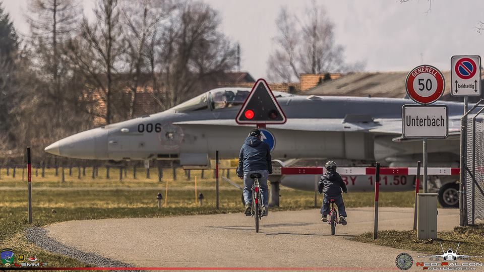
| WHERE | There is a road called “Unterbachstrasse” which crosses the runway close to the threshold of 28. Park your car at the airport visitor parking lot and then walk a few meters to a barrier/Tiger F5 at the runway, which of course will be closed when there are activities on it. You can stay at the barrier/Tiger F5 for almost the whole day (south).In the summer mornings/evenings you can cross the runway and walk to the other side (north).Parking directly at the northern point is no longer possible. We recommend you to use the official visitor parking lot of the airport and walk the way up by crossing the runway. |
| WHAT | Arrivals and departures both runway. |
| TIME | South: All day in winter. Not early morning/evening in summer. North: Early morning/evening in summer only |
| MISC. | Nothing nearby so take what you need before coming at this spot. |
| FOCAL LENGTH | 200-300mm |
South:


North:


| Spot #7 – Line-up Runway 28 |
|
|---|---|
| WHERE | From the spot 6, just walk few hundred meters on the small path until you reached the line-up position on runway 28. |
| WHAT | Good location to have face to face F5, FA18 pictures and also arrivals runway 28. |
| TIME | Early morning in Summer, no good during winter time. |
| MISC. | Nothing nearby so take what you need before coming at this spot. |
| FOCAL LENGTH | 200-300mm |


| Spot #8 – The Cliff | |
|---|---|
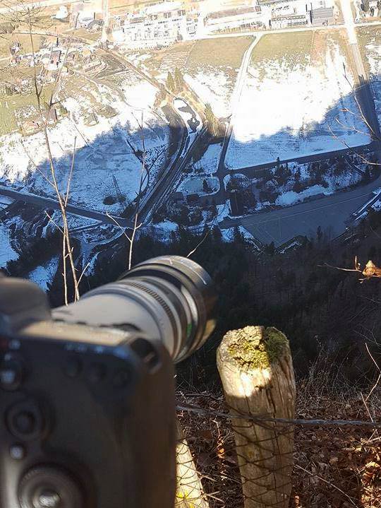
| WHERE | That’s a tricky way to go up to Mountain. Theirs two possible way to go up there. First, from spot 6, drive back on the main road direction right “Grimsel” and follow the road for maybe 5-7 minutes until the roundabout where you will have to take on the right and continue on the road “Balmstrasse” until you see the sign “Zaun” where you will have to take the road on the left. This road will guide you to the top of the mountain. It takes approximately 30 minutes. From there, I just recommend you to have a look on the map and follow the itinerary as it is pretty complicate to explain the location. |
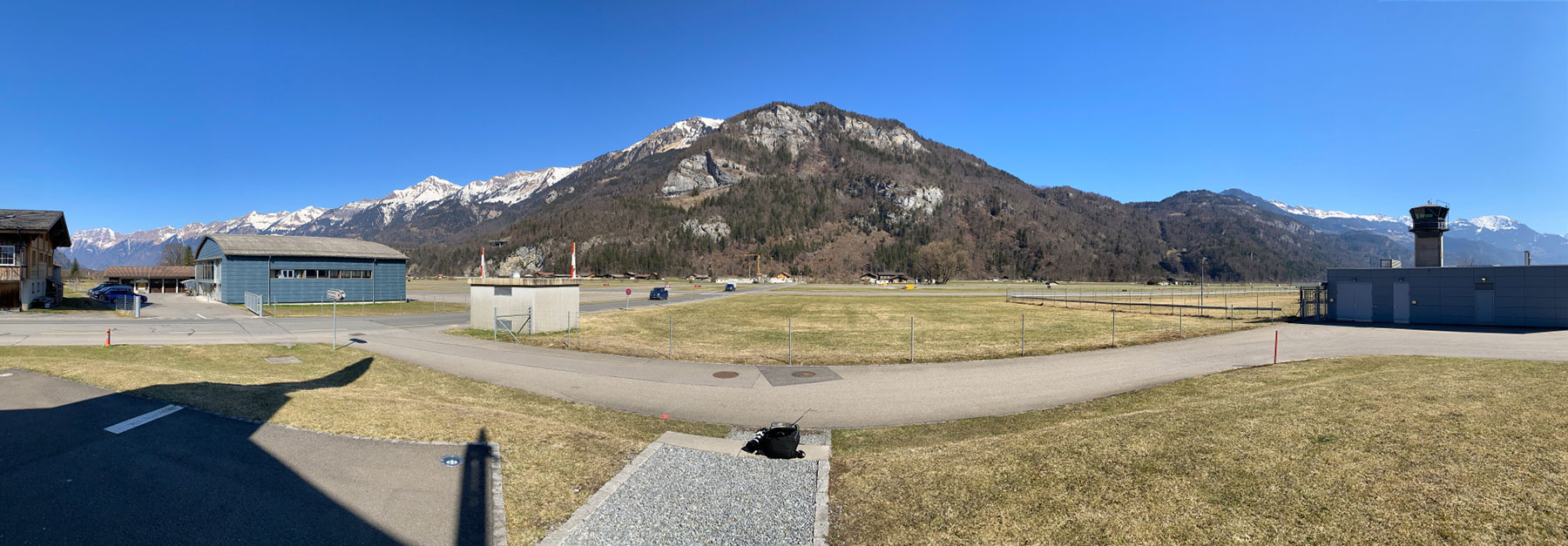
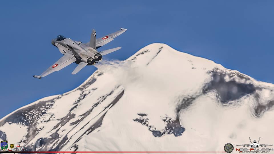
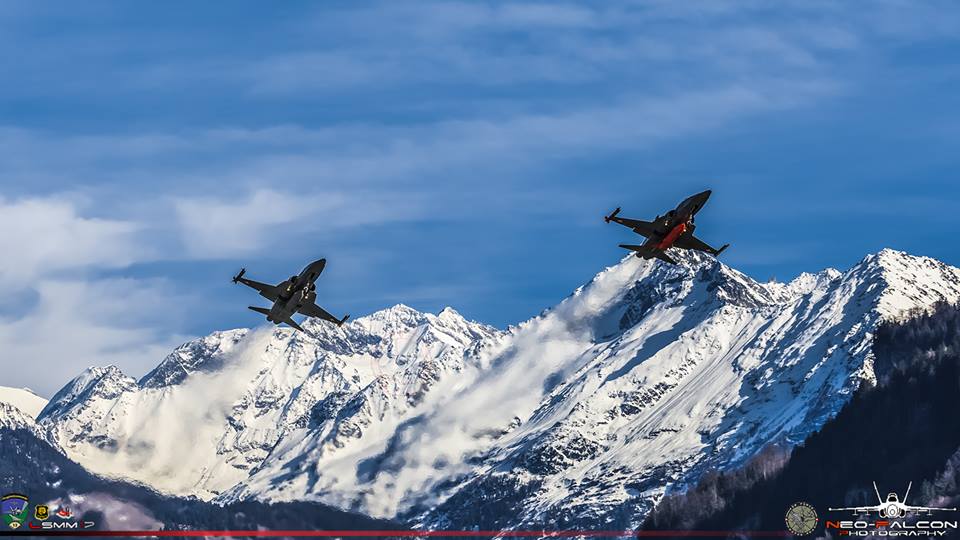
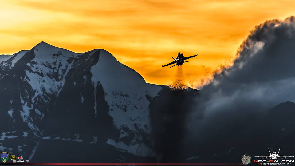
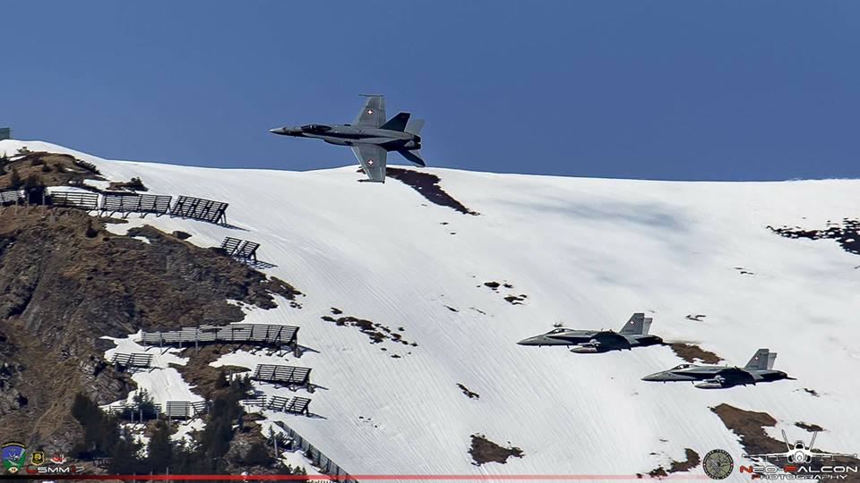
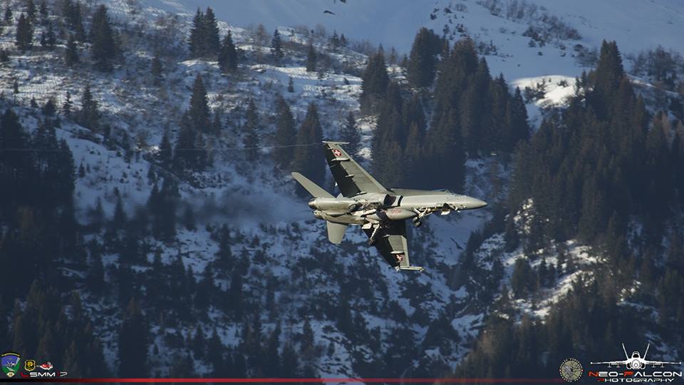
| WHAT | This is the most dangerous spotting location of Meiringen. From here you are taking pictures near a cliff edge of 300 meters with only a small fence to “protect” you. We recommend you not to rely on the fence. It’s a tinny place, only 2 people can take pictures, the place is pretty narrow due to trees branches. Theirs the big waterfall on your left, approximately 50 meters.
Park your car next to the farm and ask politely the farmer in GERMAN if you can park the car here because you want to take pictures of the Swiss Hornets. Ideally 1 car. Good for night shots and park aircraft on the ground. |
| TIME | A lot of shadows during the day due to the trees and the mountain. Best night shots. |
| MISC. | Nothing nearby so take what you need before coming at this spot. |
| FOCAL LENGTH | At least a 400mm, bigger would be much better specially for landings and departures aircraft. |


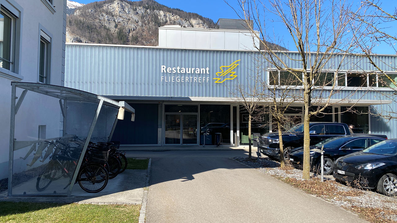
| Spot #9 – Restaurant Fliegertreff/Terrace | |
|---|---|
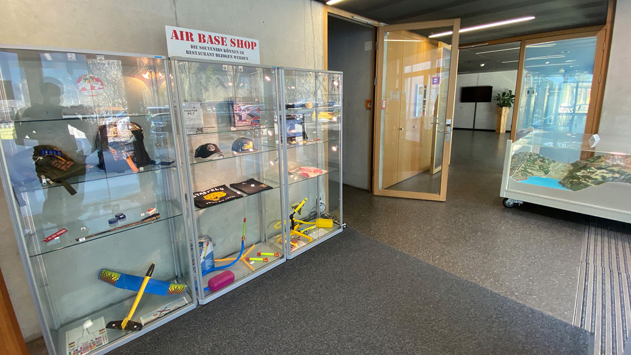
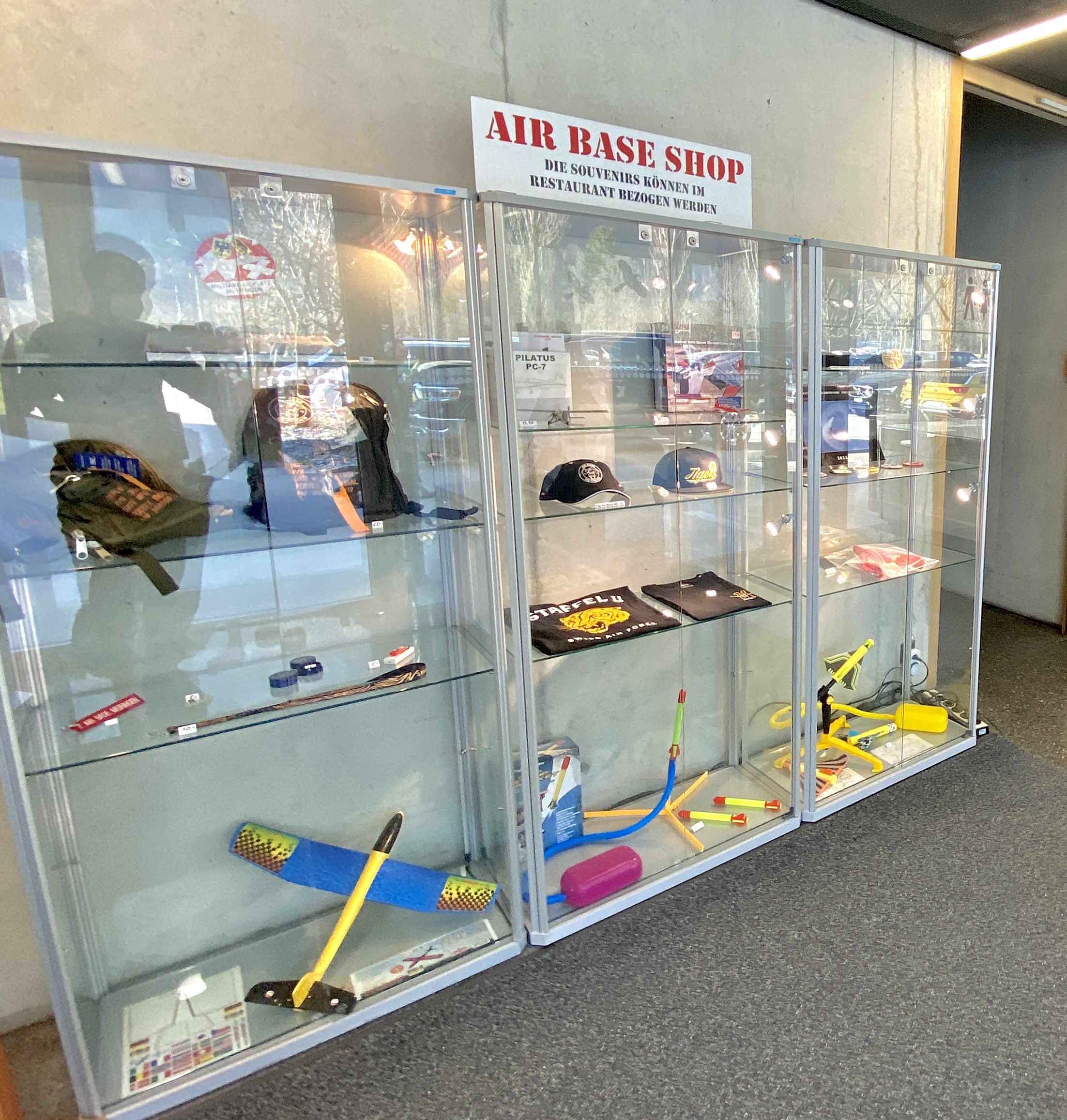
| WHERE | There is more or less the airport building, with a souvenir shop and a restaurant, mainly used by the staff of the base, but it is also open for public. Park again at the official vistior parking lot and cross the road to entrance if the building. You can`t miss it. There is a souvenir shop at the entrance and on the left is the bistro/restaurant. You don`t have to order something and you can go straight to the top by turning right at the entrance and use the stairs up to the second floor/rooftop. Keep in mind the building is not open 24/7! |
| WHAT | Similar to spot 6. You will see all runway activities from here. You are on a higher level and somtimes you are on the same level as the planes causing a fantastic background in your photos. |
| TIME | All day in winter. Not early morning/evening in summer. |
| MISC. | There are some benches on the top. If you wanna eat something at the Bistro check the opening hours on their website. Cash only. Closed on weekends. |
| FOCAL LENGTH | 250-400mm |
Hello! thanks a lot for the awesome guide! i’m planning to visit this base next month, during the first days of August to be precise, just would like to know if the base would be closed this year too? thanks in advance
Per the 2024 schedule, the base is no fly the first two weeks of August.
Cuando suele haber movimientos
Hello do the fighter jets taxi every time from the cave (spot 2) ?
Hello, not every time. They also have their hangars between the spot 2 and the runway. You can see two large buildings which are use to accommodate the fighters as well.
Hi, visiting Meiringen some day between 9-12.2.2023. Does the sunlight hit the airfield in that time of the year or does it still hide behind the mountains?
Hello!
Planning a visit for the last week of july. According to schedule it seems there are no flight plans at all for that time. Does this mean not a single figthercraft will fly?
Interested on spots 2 and 9.
Is the souvenir shop good (swiss air force memorabilia)? Or just some toys for Kids?
Thanks a lot
Hello Luis,
Indeed, I can confirm you NO FLIGHTS at LSMM during July & August. Based is closed.
The traffic will be moved to Emmen in July and Payerne in August. Below I’ve added the guide information for the two other bases including programs.
Guide for Emmen: https://www.spotterguide.net/planespotting/europe/switzerland/emmen-air-base-eml-lsme/
Guide for Payerne: https://www.spotterguide.net/planespotting/europe/switzerland/payerne-air-force-base-lsmp/
In regards to the shop I sadly don’t have any accurate information.
All the best,
Jeremy
Hi Jeremy – do you know if the base will be closed in July/August 2024 as well? Thank you!
Hey Luis,
I can give you more information about the shop as I have been to the shop in March. But if you look at spot 9 the second pic you can already see most of the stuff. They mainly have their merch for their “staffel” which is based there. I attached you a link to their shop online, there you can see the design (they have only a shirt in their base). I have the Shirt which fits nice, they have caps, badges, lanyards,usb sticks and backpacks. Also general stuff like a model plane and kids stuff. So its not a Swiss airforce shop and mostly for the base only. In my eyes its good if you are there already but driving down only for the shop from Emmen or Payerne makes no sense. Even I don’t know if they are open when the base has no flights.
Hope it helps you a bit.
https://fliegerstaffel11.shop.trikora.com/
SORRY, very wrong information because of the parking facilities !!! It is FORBIDDEN to park next to the street or in the farmers field. It would be very nice, if foreign photographers also respect that. I’m a local and grew up next to the air base meiringen / unterbach and i knwo the “ruels of the game”. sunny greetings from the bernese oberland, peter
Hello Peter,
Please tell us where should we change the parking position in that case and we will be more than happy to update the guide.
Kind regards,
Jeremy Denton
Hi Jeremy
at spot 3: 10 official parking spaces on the diagonal taxiway (golf). at spot 4: 3 official parking spaces at the intersection (Waldey) on the left side of the street at the barn. at spot 5: 2 official parking spaces at the transformer station next to the guard house (white building)
Kind regards and best wishes
Peter
Hi Peter,
Thanks a lot for your help. I have just amended the map. Please let me know if that’s not correct.
Have a good weekend.
Jeremy
Hi Jeremy
yes the new parking spaces are now correctly marked on the map. Thank you for customizing it. This way, no fotographers will get into trouble and everything is fine. I wish you a good week.
Greetings from switzerland
Peter
Please change the parking recommendations!This behavior is controversial for us spotters! Who behaves like this draws the displeasure of the farmers and finally it hurts everyone who takes photos at the air base.There is enough parking space that can be used, you have to walk a few meters.
Hi Olivier,
We would be happy to update the guide however with the information that you have provided we can’t do anything as we are missing the spot number and where we have to move the parking place.
Kindly ask you to use the following link in order to send us the update: https://www.spotterguide.net/missing-photos-location/
Thank you,
Regards,
Jeremy
A lot of wrong car parking. That’s not good. Please change that! And please dont work with Neo Falcon! He has no idea. 😉
Hi Michael!
Can you tell us something about the parking situations?
I think it’s our decision who we are working with and if you say “he has no idea”, you should consider he just provided the pictures and no information 😉
Regards, Severin
I have not been here but looking on Google Maps it seems there is a bus (174) which goes from Meiringen Banhof to Brienzwiler Banhof operating once per hour and stops right outside the base near spots 2 & 3. There is also a hotel/restaurant showing on the map at this point.
Getting vertigo just looking at that last cliff picture…….